Best Cities in Mexico for Expats 2025 | Latam Living
Best Cities in Mexico for Expats TL;DR
We go over some of the best cities in Mexico for expats to live ensuring there is something for everyone. From “lit” beach party scenes for young digital nomads, to serene tranquility in the highlands for seniors. First, we jump into a brief history of Mexico, as we feel it’s important for wanna be expats to know a bit about the country they’re considering calling home. It’s not too long, promise. We then touch on aesthetic surgical and non-surgical procedures as well as medical tourism. We then delve into numerous cities and towns that are bound to fit certain expats wants and needs.
Mexico
Mexico, located in the southern part of North America, borders the United States to the north and Guatemala and Belize to the south. It spans diverse zones including the Bajío region, Caribbean, central highlands, Gulf coast, Pacific coast, northern deserts, and the Yucatán Peninsula. With a 2025 population of roughly 132 million, it’s the most populous Spanish-speaking country in the world. Mexico’s 32 federal entities are called “estados,” as opposed to Colombia’s departamentos or Ecuador’s provincias. Mexico ranks first in the Western Hemisphere and seventh globally for UNESCO World Heritage recognitions, with 35 cultural and natural sites inscribed. Mexico is known for its contributions to global cuisine, its mysterious ancient civilizations including the Aztec, Maya, Mixtec, Olmec, Purépecha, Toltec and Zapotec, and for shaping world history through its artistic traditions, colonial legacy, and Indigenous heritage.
Mexico Vacation Superpower
Cancún stands out as the most visited beach destination globally, having welcomed over 18 million tourists in 2023, surpassing previous records and highlighting its international appeal. Other notable coastal destinations include Cozumel, Isla Holbox, Isla Mujeres, Los Cabos, and Puerto Vallarta, each attracting travelers with their unique offerings and natural beauty.
Brief History of Mexico
Aztec, Maya, Mixtec, Olmec, Purépecha, Toltec and Zapotec Lived in Mexico
Mexico was originally inhabited by ancient cultures whose history and legacy is recognized worldwide. The first tribe recognized by most historians in Mexico are the Olmecs which means “rubber people”. They are thought to have lived around the east coast state of Veracruz and parts of Tabasco. Other civilizations followed including the Aztec, Maya, Mixtec, Purépecha and Toltec. The Aztec and Maya civilizations are the most well-known. The Maya left behind important historical sites such as Chichen Itza, Palenque, Tulum and Uxmal. Teotihuacan, meaning City of the Gods in the Aztecs’ native Nahuatl language, was their center and capital. It’s the most important and visited Aztec ruin. Current day Mexico City was basically built around Teotihuacan. It’s located very close to the heart Mexico City. The sites left behind by both the Aztec and Maya civilizations continually draw a great deal of tourists from all over the world.
Hernán Cortés Conquers the Maya and Meets La Malinche
Hernán Cortés Leaves Cuba for Mexico
In 1519, Hernán Cortés disobeyed the first Governor of Cuba, Diego Velázquez de Cuéllar, and hurried his departure from Cuba to carry out his expedition to what would now be Mexico. Cortés landed for the first time on the coast of what is now the island of Cozumel. Shortly thereafter, the Spanish arrived in Yucatán, where they met the Maya. Hernán Cortez and the Spanish royal army conquered the Maya. The Maya gave Cortés gifts, including 20 female slaves.
La Malinche
La Malinche aka Marina, Malintzin, was a valuable resource since she knew how to speak Maya and Nahuatl; Nahuatl being the language of the Aztecs. La Malinche was born in Oluta, Veracruz. She learned some Spanish while being enslaved by the conquistadors. She became Cortés most faithful companion. Malinche’s linguistic abilities were discovered when the Spaniards met Nahuatl-speaking people at San Juan de Ulúa. Cortés spoke Spanish to his interpreter Jerónimo Aguilar, who would then pass on the message to La Malinche in Maya/Spanish. She in turn would translate to Nahuatl for Moctezuma’s Emissaries. Replies to La Malinche would reverse the chain. La Malinche and Cortés had a son named Martín Cortés, wrongly considered the first mestizo by many.

Aztec Leader, Moctezuma II Is Killed by the Spanish
The Spaniards landed in Veracruz in 1519, founding Villa Rica de la Vera Cruz where they encountered Aztec emissaries. From there, they marched inland to Tenochtitlán, the Aztec capital (now Mexico City). Emperor Moctezuma II, believing Cortés might be a returning god, welcomed him with honor at the Axayácatl palace. However, the Spanish took Moctezuma II hostage and later killed him. The Aztec empire fell on August 13, 1521, when Moctezuma’s successor, Cuauhtémoc, was captured and later executed in 1525.
“Grito de Dolores” and End of Spain’s 300-Year Rule

Beginning of the End for Spain
The Viceroyalty of New Spain existed for 300 years from 1521 to 1821. Its first Viceroy was Antonio de Mendoza y Pacheco, who ruled New Spain for 15 years, and later died in 1552 after a brief stint as Viceroy of Peru. After 286 years of Spanish rule, on September 16, 1810, a Priest by the name of Miguel Hidalgo y Costilla summoned the residents to rise up in arms and fight for the independence of Mexico. This historical act is known as the Grito de Dolores. It occurred in the city of Dolores Hidalgo, Guanajuato. After 11 years of war, Mexico became independent from Spain on September 27, 1821, although Mexico celebrates its’ Independence Day on the day of the Grito on September 16th each year.
Mexico Loses Territory After Gaining Independence
The financial cost to fight for Mexico’s independence from Spain created a financial crisis and Mexico subsequently lost control over Central America. Furthermore, Texas gained independence from Mexico and joined the United States. US President James K. Polk declared war on Mexico on March 13, 1846. The Mexican-American War ended on February 2, 1848, with the Treaty of Guadalupe Hidalgo, establishing peace and friendship between the United States and Mexico. Mexico ceded territories including Arizona, California, Colorado, Nevada, New Mexico, Utah, and parts of Kansas, Oklahoma, and Wyoming. The treaty also defined the border from the Gulf of Mexico to the Pacific Ocean.
Mexico Medical and Pharmaceutical Tourism
Medical tourism is big business in Mexico, driven by proximity to the US and significantly lower prices. Many Americans cross the border daily for doctor’s visits, dental work, and prescription medications. Savings range from 39% to 80% compared to US costs. One of the biggest draws is pharmaceutical tourism—especially in Tijuana—where Americans buy medications at a fraction of US prices. A US Congress study cited by the Salt Lake Tribune found Americans pay nearly four times more for the same drugs than people in 11 other wealthy nations. Mexico’s government negotiates capped drug prices. COFEPRIS (Spanish), Mexico’s equivalent of the FDA, provides regulatory oversight to ensure drug quality and safety. According to the Mexican Council of the Medical Tourism Industry (CMITM), medical tourism brings in more revenue than traditional tourism—worth around $3.3 billion USD per year.
Border Towns & Tourist Destinations Provide Medical Care
Patients visit border cities and towns such as Matamoros, Mexicali, Nuevo Laredo and Tijuana, with Tijuana being the most visited. Additionally, some patients visit more traditional tourist destinations such as Cancún, Guadalajara, Los Cabos, Mexico City, and Puerto Vallarta. The procedures that draw the most visitors are bariatric surgery, cardiology, cosmetic-reconstructive surgery, fertility, gastro-surgery, oncology, ophthalmology, orthopedics, orthodontics, trauma and spine surgery.
Global Medication Packaging: The US Stands Alone
United States
- Medications are dispensed in amber pill bottles, repackaged and labeled by pharmacists.
- This system supports customized dosing, flexible quantities, and integrates with insurance billing and refills.
- The US is the only country that routinely uses this bottle system as standard practice.
The Rest of the World
In Africa, Asia, Central and South America, Europe, North America (excluding the US), and Oceania, medications are sold in sealed cartons with blister packs, still in their factory packaging. The rest of the world prioritizes unit dosing, hygiene, tamper resistance, and cost efficiency by keeping medications in their original packaging.
Why the Difference?
The US system evolved to support custom dispensing and tight integration with insurance billing, favoring repackaged pill bottles over manufacturer-sealed blister packs. Other countries emphasize unit dosing, patient safety, and cost efficiency by keeping medications in their original packaging.
| Feature | United States | Rest of the World |
|---|---|---|
| Advertising Allowed | Yes (only US and NZ) | Rare or illegal |
| Handling | Pharmacist counts and labels | Sealed by manufacturer, unopened |
| Hygiene/Safety | Moderate (open containers) | High (tamper-evident packaging) |
| Packaging Format | Repackaged amber plastic pill bottles | Original manufacturer-sealed blister packs |
| Reasoning | Custom dosing, insurance-linked | Consistency, safety, shelf life |
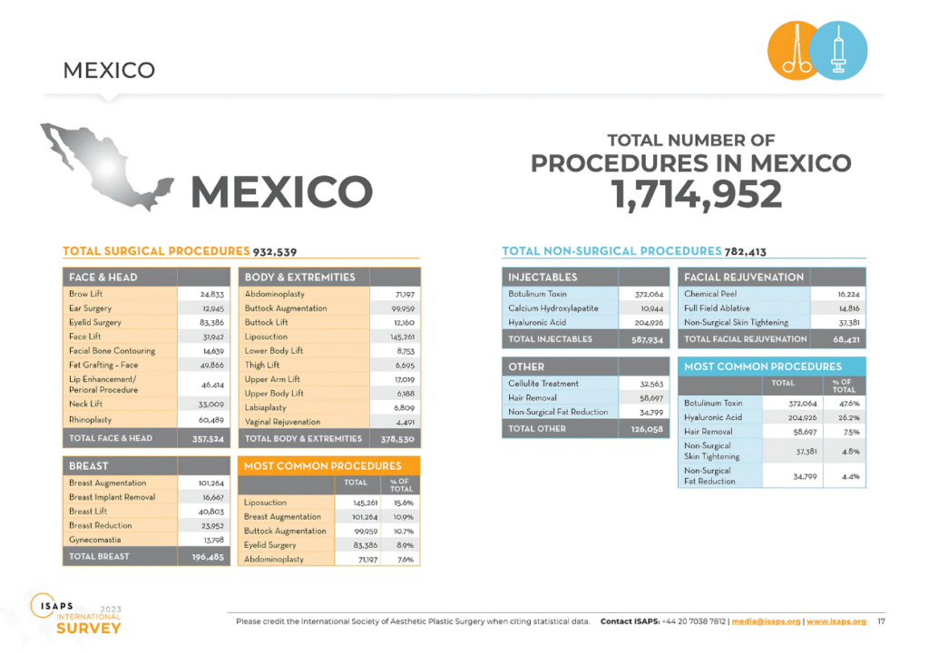
Mexico Ranked 3rd Worldwide for Aesthetic Surgery
There are 96 hospitals certified before the Consejo de Salubridad General (CSG in Spanish) and 9 accredited by the International Joint Commission. The aesthetic procedures and/or surgeries that are performed the most in order of number of procedures are: liposuction, breast augmentation, eyelid lift, tummy tuck, and rhinoplasty. The most common non-surgical procedures are Botox, hyaluronic acid, nonsurgical fat removal, hair removal and photo rejuvenation.
Mexico 3rd Place Behind Brazil and the United States
In 2023, 1,714,952 aesthetic surgical and non-surgical procedures were performed in Mexico. That’s a whopping 444,347 more than in 2021 and places Mexico as third worldwide behind the United States and Brazil. The demand for both surgical and non-surgical procedures keep growing. Incidentally Brazil had the highest number of surgical procedures while the United States had the highest number of total procedures including non-surgical. You can check out the worldwide cosmetic surgery statistics at IASPS.
Exports and Tourism Drive Mexico’s Economy
Illicit activities aside, the main driver of México’s economy are exports and tourism. Tourism in Mexico is huge. Mexico is the second most visited country in the Western Hemisphere, after the United States according to the World Tourism Organization. Numerous cities and towns in Mexico are filled with colonial charm, while others beckon beachgoers. Mexico’s top tourist destinations are Cancún, Guadalajara, Los Cabos, Mérida, Mexico City, Oaxaca, Playa del Carmen, Puerto Vallarta, San Miguel de Allende, and the Riviera Maya (Playa del Carmen and Tulum). Cancún isn’t technically part of the Riviera Maya, although it might as well be.
Mexico’s Chief Exports
Mexico’s main exports are in the automotive, beverage, cement, and textile industries. The Mexican company Cemex is the third largest cement conglomerate in the world. Mexico has Free Trade Agreements (FTAs) with 46 countries.
CUSMA, NAFTA and T-MEC, the 3 Country Trade Alliance
The best-known trade agreement is the renegotiated North American Free Trade Agreement (NAFTA) with the United States and Canada. The new agreement dubbed NAFTA 2.0 was signed by President Trump, Mexican President Enrique Peña Nieto, and Canadian Prime Minister Justin Trudeau on November 30, 2018, as a result of the three leaders meeting at the 2018 G20 Summit in Buenos Aires. A revision of the agreement was signed on December 10, 2019, and was ratified by all three countries, with the final ratification (Canada) on March 13, 2020.
New “NAFTA” Gets a New Name
Interestingly the new “NAFTA” got a new name. In Mexico, the agreement is called T-MEC (Spanish) “Tratado entre-México, Estados Unidos y Canada” abbreviated T-MEC by simply using the first letter of each country after the T, hyphen, and naturally putting Mexico first. In the United States it was signed into law under USMCA, amusingly not too far off from the Village People’s classic hit song YMCA or the United States Marine Corps (USMC). It stands for “United States Mexico Canada Agreement”. Again, naturally the United States places their country first in the acronym. Thirdly, Canada follows suit by officially naming the agreement CUSMA, the acronym for “Canada United States México Agreement”, with Canada putting its nation first in the abbreviation.
UNESCO Recognizes Mexican Gastronomy
Mexican cuisine was awarded the Intangible Cultural Heritage of Humanity honor by UNESCO in 2010 due to its creativity, diversity, history, and transcendence. The culinary techniques and ingredients used represent traditions that are centuries old yet still form part of everyday life in Mexico. There’s a great diversity of colors, flavors, textures and mastery involved. Most of the 32 states have their own specialty, whether it’s Cochinita Pibil in Yucatán, delicious moles in Oaxaca, tortas ahogadas in Jalisco, tacos al pastor in CDMX or tacos de marisco on the Mexican coast. Mexican food is based on the use of agave, amaranth, avocado, beans, cocoa, corn, nopal, tomatillo, tomatoes, squash, vanilla, and of course numerous types of chili peppers. Although purely vegetarian dishes exist and are growing in popularity, most recipes add some type of meat whether it is chicken, ground beef, pork, seafood or steak.
Mexican Food is More than Just Tacos
Without question tacos are king in Mexico whether it be al pastor, barbacoa, birria, canasta, carnitas, cochinita pibil, or seafood. However, Mexico offers so much more delicious food than just tacos. Burritos (mostly in northern Mexico), chilaquiles, chiles en nogada, consome de pollo, flautas, gorditas, mole, pozole, sopa azteca, sopa de frijol, sopa de lima (mostly in the state of Yucatán), sopes/huaraches, tamales, tlayudas, are just a few that come to mind.
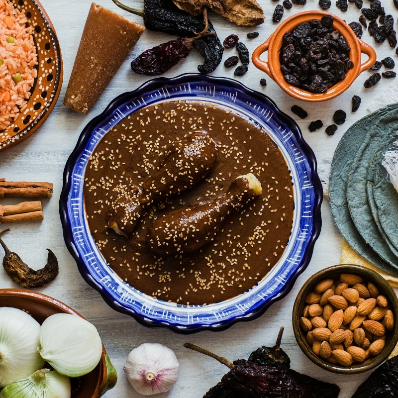
Oaxacan Moles Are Delish
Due to the vast assortment of chili peppers, there’s a wide variety of moles and spice levels to choose from. Moles can have up to 30 ingredients and are quite labor intensive to prepare. The state of Oaxaca is known for their seven moles. Many consider Oaxaca to have the best food in Mexico. Oaxacans and other Mexicans also eat grasshoppers called chapulines. No thanks. Additionally, Oaxaca is well-known for the production of mezcal, a smoky, artisanal agave-based spirit.
Tacos Have Toppings
Hot sauce, pico de gallo (sometimes just diced onion), cilantro, limes and pineapple (for tacos al pastor) are often seen accompanying tacos in Mexico.
Best Cities in Mexico for Expats Overview
I’m Confident There’s a Place for Everyone
I’ve categorized different types of expats. Most people, not all, fall into one of the categories below. Trust me, I know not everyone fits in a box. At the beginning of a new city section. I’ll include which type of expat would typically fit best. I won’t list these for smaller towns or quick mentions, only cities popular with expats.
- The young, single digital nomad
- The young couple
- The older, single person (me)
- The social security retirees (singles or couples)
- The rich of any age
- Senior citizens
Mexico City, Mexico (CDMX)
Mexico City, Ideal for:
- The young, single digital nomad
- The young couple
- The older, single person
- The rich of any age
CDMX: Culture, Business, and Politics Converge
Mexico City is the capital of Mexico. It’s the cultural, economic and political center. It’s one of the most important cultural and financial centers in the world with an enormous population. Mexico City was abbreviated Distrito Federal or “DF” for 192 years but in an effort to rebrand the country; former President Enrique Pena Nieto signed a reform on January 29, 2016, to change the name to just Mexico City along with the acronym CDMX. The full transformation wouldn’t actually take place until 2018. The rebranding was explained as a decentralization effort to delegate power from the federal government thus allowing the city’s mayor to name senior officials including the police chief. It also turned the capital’s 16 boroughs into municipalities, with their own mayors and councils.
Mexico City Climate
Mexico City’s climate is subtropical highland (Köppen Cwb), with average daily temperatures of 20-24°C (68-75°F). The dry season, from November to April, brings sunny, mild days with low humidity. The rainy season, from May to October, sees afternoon showers with moderate humidit
Mexico City Crime
Mexico City has a reputation for crime, but the reality is more nuanced. As of June 2025, the city has a crime index of 54.2, lower than Guadalajara’s 62.3. The homicide rate stands at 8 per 100,000 residents—well below Guadalajara’s 21.5. Theft, robbery, and vehicle theft are the most common crimes. While safety during the day is considered moderate, locals report feeling far less secure at night, especially in certain neighborhoods.
Safety Concerns in Mexico
Mexico has high crime in many cities. It’s important to be aware of your surroundings and take basic safety precautions that I’m sure you’ve read or heard about a thousand times. Check out the tabs below concerning safety tips in Mexico that could apply to anywhere.
I know people want to have fun and for those that drink, I get it. Although I quit drinking, I know what it’s like to be young and want to party. I want people to have fun and “live”. Don’t go to bad areas and don’t get too wasted in some sketchy part of the city. Do your own research in advance of where you’ll be going and let your friends and/or family know where you’ll be at all times. On the other hand, don’t let strangers know your whereabouts.
Also, if you drink make sure you have your drink with you at all times. Don’t go to the bathroom and leave your drink at the bar and come back and drink it. Scopolamine is a drug used in Medellín, and other parts of Colombia to knock people out and rob them of their belongings. I’m guessing Colombia isn’t the only country where this happens.
Contrary to popular believe there are white Mexicans or “Whitexicans” (yes, it’s a term that’s used). Mexico City, with almost 23 million inhabitants is fairly diverse. Your ability to blend in is based on the fact that they’re used to seeing foreigners.
Be careful with your cell phone. Of course, you want to have a good time and get some Instagram worthy pics or videos but just be aware of your surroundings. Be extra cautious at night. Use your gut instinct. We have very powerful instincts. We just need to listen to them.
I don’t recommend bringing any excessive jewelry whatsoever to Mexico. Even if it’s fake and “worth nothing”, a thief doesn’t know that and may still attack. Leave the bling at home.
Personally, I’d stay away from wearing Crocs or Tevas. Otherwise just wear comfortable shoes while in Mexico City. It’s a great walking city and I’m sure you’ll be doing a lot of it.
If you want to do a Tepito tour in Mexico City or any tour for that matter, do it during the day with a reputable tour company. Check on Trip Advisor.
Mexico City Traffic
Pollution
Mexico City, being one of the most populated cities in the world, suffers from air pollution. According to a study carried out by the IMECA (Metropolitan Air Quality Index) air pollution in Mexico City (Spanish) can cause serious health problems. INEGI statistics report that there are 4.7 million vehicles, 80% of which are for private use. Gas powered cars, motorcycles and other vehicles cause pollution. The government of Mexico City implemented a program called the air pollution index. Conditions are updated so citizens can see the air quality before venturing outside.
Hoy No Circula and Vehicle Verification
Like Colombia (Bogotá and Medellín) and Quito, Ecuador, Mexico City has similar program. It’s called Hoy no Circula (No Driving Today). It was created in an effort to curb air pollution and congestion. Additionally, The Vehicle Verification Requirement of Mexico City (Spanish), checks the emissions of registered cars. Vehicles must pass the test in order to register. Hoy No Circula limits driving in the city on established days determined by the vehicle’s registration number (Spanish).
Mexico City Transportation
México City International Airport (MEX)
Mexico City International Airport (MEX) is 5 kilometers (3 miles) east of downtown. It handled 47.3 million passengers in 2024 and is Mexico’s busiest airport. Passengers can fly non-stop to 25 countries on 64 international routes, in addition to 44 direct domestic connections across Mexico.
Integrated Mobility Card
The Tarjeta de Movilidad Integrada is a contactless smart card used across multiple public transport systems in Mexico City, including the Metro, Metrobús, Ecobici, Cablebús, Light Rail (Tren Ligero), RTP buses, and Trolleybuses. The card costs 15 pesos and can be purchased and recharged at Metro stations, Metrobús stations, and other authorized locations.
Metro
The Mexico City Metro is the city’s primary rapid transit system, consisting of 12 lines that cover extensive areas of the city. The fare is 5 pesos per ride, payable with the Integrated Mobility Card. The Metro operates from 5 a.m. to midnight on weekdays, 6 a.m. to midnight on Saturdays, and 7 a.m. to midnight on Sundays and holidays.
Local Metrobús
The Metrobús is a bus rapid transit (BRT) system with dedicated lanes, comprising seven lines that traverse major city corridors. The fare is 6 pesos per ride, and payment is made using the Integrated Mobility Card.
Regional Buses
Mexico City’s regional bus services operate from several major terminals, including Terminal de Autobuses de Pasajeros de Oriente (TAPO), Terminal de Autobuses del Norte, Terminal de Autobuses de Poniente (Observatorio), and Terminal de Autobuses del Sur (Taxqueña). These terminals connect Mexico City to cities all throughout Mexico. All 5 companies have mobile apps. Check out bus company specifics and route info below.
RTP Buses
The Red de Transporte de Pasajeros (RTP) operates various bus services, including ordinary, express, eco-friendly, women-only (Atenea), school, and night services (Nochebús). Fares range from 2 to 7 pesos, depending on the service type.
Trolleybuses
Operated by the Servicio de Transportes Eléctricos, the trolleybus network offers electric bus services along several routes. Fares are typically 4 pesos per ride, payable with the Integrated Mobility Card.
Cablebús
he Cablebús is an aerial cable car system serving hilly, underserved parts of northern and eastern Mexico City. Line 1 connects Indios Verdes to Cuautepec in Gustavo A. Madero. Line 2 links Constitución de 1917 to Santa Marta in Iztapalapa. The fare is 7 pesos per ride.
Ecobici
Ecobici is a public bicycle-sharing program with over 6,000 bicycles and numerous docking stations throughout the city. Users can access bikes using the Integrated Mobility Card or the Ecobici app.
Taxis, Rideshares, and Rentals
Taxis and ridesharing apps InDrive, DiDi and Uber are available. Rideshare apps are recommended for affordability, cleanliness and safety. For taxis, the city government recommends using authorized taxi stands (sitios) for safety. Cars can be rented at Benito Juárez International Airport (MEX) from Alamo, Avis, Budget, Enterprise, Fox, Hertz, National, Payless, and Sixt. Once downtown, you can rent from local agencies Mex Rent a Car and Royal Rent a Car in addition to the global brands.
Mexico City 7th Most Populated in the World
According to United Nations estimates, Mexico City has a population of 22,752,400 putting it just under São Paulo, Brazil at 22,990,000. This puts it as the 7th most populated city in the world and 2nd most in the Western Hemisphere. Depending upon what chart one refers to, Mexico City and São Paulo may often flip flop their ranking depending upon the organization classifying the cities.
Globalization and World Cities Research Network “GaWC”
Globalization and World Cities Research Network “GaWC” categorizes the importance of world cities into the following global scales with economics weighed more heavily than political or cultural factors:
Alpha++ Cities
According to GaWC’s interpretation, “In all analyses, London and New York stand out as clearly more integrated than all other cities and constitute their own high level of integration.”
Alpha+ Cities
According to GaWC’s interpretation, “Other highly integrated cities that complement London and New York, largely filling in advanced service needs for Pacific Asia.”
Alpha & Alpha- Cities
According to GaWC’s interpretation, “Very important world cities that link major economic regions and states into the world economy.”
- Alpha++
- Alpha+
- Alpha
- Alpha-
Beta Level Cities
According to GaWC’s interpretation, “These are important world cities that are instrumental in linking their region or state into the world economy.”
- Beta+
- Beta
- Beta-
Gamma Level Cities
According to GaWC’s interpretation, “These can be world cities linking smaller regions or states into the world economy, or important world cities whose major global capacity is not in advanced producer services.”
- Gamma+
- Gamma
- Gamma-
Cities with Sufficiency of Services
According to GaWC’s interpretation, “These are cities that are not world cities as defined here but they have sufficient services so as not to be overtly dependent on world cities. Two specialised categories of city are common at this level of integration: smaller capital cities, and traditional centres of manufacturing regions.”
- High Sufficiency
- Sufficiency
Mexico City Ranks “Alpha” According to GaWC
Mexico City was categorized as Alpha in GaWC’s 2024 findings. It was accompanied by the following cities: Amsterdam, Bangkok, Chicago, Frankfurt, Guangzhou, Istanbul, Jakarta, Kuala Lumpur, Los Angeles, Madrid, Mexico City, Milan, Mumbai, Sao Paulo, Seoul, Toronto and Warsaw. Only 8 cities were recognized as Alpha + while just 2 were listed as Alpha ++, London, England and New York City, United States. GaWC cited them as “clearly more integrated than all other cities and constitute their own high level of integration.”
Mexico City Tourism
Tourism in Mexico City is a great source of revenue. Approximately 11 million domestic and foreign tourists visit CDMX yearly with roughly 2 million of them being foreigners. Mexico City is the number one tourist destination for foreigners in Latin America generating approximately $600 per visitor. CDMX has charming neighborhoods and lots of parks and green spaces. There are handicraft and street food vendors throughout the city. There are approximately 150 museums in Mexico City ranking it second after London.
Mexico City Centro Histórico
The center of Mexico City was built by the Spaniards in the 16th century on the ruins of Tenochtitlan, the ancient Aztec capital. There are 1,500 buildings including galleries, hotels, museums, shops, temples, and theaters. A few points of interest are, Antiguo Palacio del Ayuntamiento (Spanish), Catedral Metropolitana, Castillo de Chapultepec, Palacio de Bellas Artes, Palacio Nacional and the Templo Mayor de Mexico Tenochtitlan. The Metropolitan Cathedral of Mexico City is the largest cathedral in Latin America.
James Bond: Spectre
One can admire the architectural beauty of CDMX by taking a stroll around the Plaza de la Constitución better known colloquially as the Zócalo. Did you see the James Bond movie Spectre? The amazing opening seen was shot around the Zócalo during a Día de Los Muertos festival with thousands of revelers dressed in catrin and catrina outfits, including Bond. As always, Bond miraculously escapes the perils of evil, albeit on a chopper whizzing around the Zócalo. The center of Mexico City was named a World Heritage Site in 1987 by UNESCO.
Castillo de Chapultepec
The National Museum of History, Castillo de Chapultepec, is located at the top of Bosque de Chapultepec. The name Chapultepec comes from the Nahuatl language chapul (in) = grasshopper; tepe (tl) = hill or mountain. In 1325, after the founding of Tenochtitlan, Chapultepec was considered sacred and strategic. It supplied the capital of the Aztec empire with drinking water.
Castle for Spanish Emperor Maximilian of Habsburg was Built
Viceroy Bernardo de Gálvez ordered construction of the palace between 1785 and 1787. It housed Spanish viceroys and Emperor Ferdinand Maximilian Josef Maria von Habsburg-Lothringen aka Maximilian I. He was ultimately shot by a firing squad in Santiago de Querétaro at age 34. Chapultepec was later used as the Presidential House until 1940. The inauguration of the National Museum of History, Castillo de Chapultepec, occurred on September 27, 1944.

Tour Castillo de Chapultepec
Definitely make it a point to tour Castillo de Chapultepec. It’s a great museum and the view of Mexico City from the hill is superb. You can visit 34 rooms and exhibition spaces that show the history of Mexico, including murals, sculptures, and various objects. Visiting hours are Tuesday to Sunday from 9 AM to 5 PM. Admission costs 100 pesos, with free entry on Sundays for Mexican citizens and residents, as well as children under 13, seniors over 60, teachers, students with valid ID, pensioners, retirees, and people with disabilities.
Condesa and Roma Norte
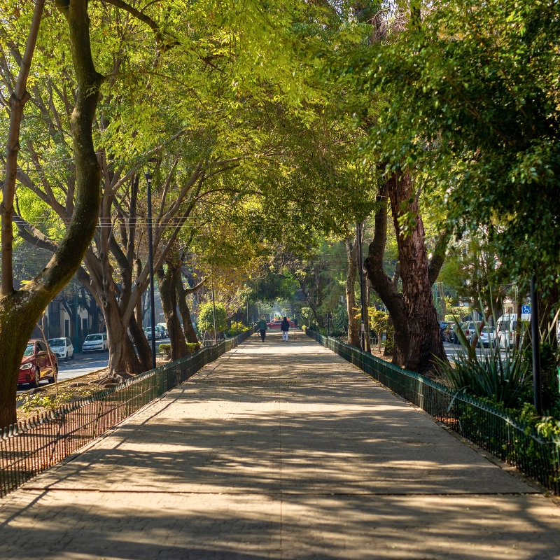
Condesa and Roma Norte are two chic neighborhoods in Mexico City not too far from the center. These neighborhoods are full of bars, boutiques, galleries, restaurants, shops, and walkable streets. There’s a bohemian vibe to them. People love walking Avenida Amsterdam. Condesa and Roma Norte have parks and green spaces. People stroll along these neighborhoods, many with their dogs in tow. They’re safe and upscale. Roma Norte is known for its night life. Both are close to Polanco which is the wealthiest neighborhood in Mexico City.
Parque Mexico
Parque Mexico is an art deco style park in Condesa where you’ll find people exercising, practicing yoga, skating, walking (many with dogs) and riding small, rented, electric scooters. Its nine hectares are laid out in an oval shape. People visit the Lindbergh Forum, which features an emblematic water fountain, a pond, and a traditional clock at its center.
Xochimilco, Mexico
Island of the Dolls is a Must See in Xochimilco
The Island of the Dolls is a must see in Xochimilco, México, especially for people that are intrigued by creepy, haunted, scary things such as clowns, dolls, ghosts and so forth. La Isla de la Muñecas has been featured on Ghost Adventures on the Travel Channel, the Amazon Prime show Lore and other television shows.
My Trip to Island of the Dolls in Xochimilco
I was fortunate enough to be able to visit Xochimilco and La Isla de las Muñecas. I was disappointed with the lack of 4K focus on my Canon EOS M50 while videotaping. Mind you, this was in 2019, and it was like high-noon, not ideal for content creation. It was the first time I shot in 4K and the first time I used a Zhiyun Weebil gimbal or any gimbal for that matter. On the positive side, I was able to capture some stills of the dolls in post that came out pretty good.
Navigate the Canals of Xochimilco in a Colorful Trajinera
The canals of Xochimilco are quite shallow and captains use a bamboo stick to navigate. It’s a tough job, I tried it. The colorful trajineras all have different names. Xochimilco is a blue-collar type of place that’s popular with locals as well as tourists. There are a couple of stands that sell drinks and simple food items but that’s about it. It’s a place where friends meet up to go out and party and get their buzz on, but also a place where you’ll see family and children enjoying the day. Overall, it’s a great people watching experience. People wave at each other as the trajineras pass one another while music is playing. There are numerous birds, like white herons, or garzas blancas in Spanish, and other fauna.

Mexico City Best Places to Live
The best areas to live in Mexico City are Condesa, Coyoacán, Interlomas, Juarez, Narvarte, Polanco, Roma (Norte y Sur), San Ángel and Santa Fe. These neighborhoods are considered safe. In addition to cafes, restaurants and shops they have parks and green spaces. Polanco has long been known as a sophisticated neighborhood where the very wealthy live. If you’re out looking for Carolina Herrera, Gucci, Hermes, Louis Vouitton, Porsche, Rolls Royce, Tiffany etc.… you’ll find it around Avenida Masaryk. Polanco is also home to the beautiful Soumaya Museum (Spanish). I believe Mexico City is one of the best cities in Mexico for expats to live that like the idea of living in a large, culture filled, chaotic capital city filled with walkable parks, numerous museums, and seemingly unlimited culinary options.
Cabo San Lucas, Baja California Sur, Mexico
Cabo San Lucas, Ideal for:
- The young, single digital nomad
- The young couple
- The older, single person
- The social security retirees (singles or couples)
- The rich of any age
Cabo San Lucas, Playground for the Wealthy
Cabo San Lucas is one of the two “Cabos” when you hear “Los Cabos”. It’s located at the southern tip of Baja California Sur, on the shores of the Pacific and Sea of Cortés. The city has 351,111 residents according to data from INEGI (2020). It is 29 kilometers (18 miles) southwest of “the other Cabo”, San José del Cabo. Cabo San Lucas is known for sportfishing, luxury resorts and lifestyles of the rich and famous.
Cabo San Lucas Climate
Cabo San Lucas’ climate is tropical desert (Köppen BWh), with average daily temperatures of 24-29°C (75-84°F). The dry season, from November to May, brings warm, sunny days with low humidity. The wet season, from June to October, sees occasional heavy rain from tropical storms with moderate humidity. The weather is a huge draw for expats and tourists. Cabo never seems to get too hot, and the humidity is quite low.
Cabo San Lucas Crime
INEGI doesn’t have crime stats for just the city of Cabo San Lucas. Instead, it provided stats for the state of Baja California Sur. In 2023, the homicide rate was 2.2 per 100,000 residents, making it the second safest state in México behind Yucatán. Outlying areas like Los Cangrejos and El Zacatal can be a bit sketchy. Although not overbearing, tourists need to be aware of potential scams and theft in the marina and Medano Beach.
Cabo San Lucas Transportation
Los Cabos International Airport (SJD)
Los Cabos International Airport (SJD) lies 45 kilometers (28 miles) northeast of downtown Cabo San Lucas. It welcomed 7.5 million passengers in 2024. SJD has Direct flights with Los Angeles, Vancouver, and México City. The airport serves 24 airlines from México, the US, and Canada.
Local Buses
Municipal buses link downtown and the marina, with departures from Cabo San Lucas’s Terminal de Autobuses on Boulevard Lázaro Cárdenas at the corner of Calle Leona Vicario, 1.3 kilometers (0.8 miles) north of the marina. Ruta del Desierto runs purple/yellow buses along the Tourist Corridor to San Jose del Cabo with numerous stops on the way; tickets are bought on-site.
Regional Buses
Regional buses depart from Cabo San Lucas’s Terminal de Autobuses on Boulevard Lázaro Cárdenas at the corner of Calle Leona Vicario, same terminal as the local buses. Regional transport up and down the entire Baja Peninsula and even into northern Sonora is available through ABC. Discover a bit about ABC bus company and the destinations they cover below.
Taxis, Rideshares, and Rentals
Rideshare apps DiDi, InDrive, and Uber operate in Cabo San Lucas, but resorts may restrict pickups at the entrance, meaning you’ll have to walk outside the property to meet your driver. Taxis are easy to find downtown and near the marina, though they don’t use a meter, so confirm your fare before hopping in. At the airport, car rentals, taxis, and shuttle services are your options, since rideshares aren’t permitted at the terminal. However, many people, like me, grab their luggage and make a short walk outside the airport to use their preferred rideshare. Cars can be rented at the airport from Alamo, Avis, Budget, Enterprise, Hertz, National and Sixt. Cactus Rent a Car and Nextcar are two local options located downtown.
Cabo San Lucas Tourism
Centro and Marina
Cabo San Lucas is best known for its marina area and lively downtown. The marina is packed with markets, restaurants and shops, plus boat tours that head out to iconic spots like El Arco. Downtown Cabo, or “Centro,” is where the nightlife pops. The main square, Plaza Amelia Wilkes, has a spot to relax and soak in the local vibe. Both areas are great for dining, strolling and snapping photos of the harbor.
San José del Cabo
San José del Cabo is just 32 kilometers (20 miles) northeast of Cabo San Lucas. Its town center has a more laid-back, traditional feel and features charming architecture, a quieter atmosphere, and a strong arts scene. The heart of this historic area is Plaza Mijares (called “La Plaza”), a tree-filled square lined with galleries, restaurants and shops. It’s anchored by the mission church, Parroquia San José, and comes alive during the weekly Art Walk in high season. The weekly Art Walk during high season brings visitors into galleries and studios, while the church and square remain a peaceful gathering place.
Costa Azul and Playa El Médano
Costa Azul and Playa El Médano are two of the most popular beaches in Cabo. Playa El Médano is the busiest, lined with beach clubs, restaurants and water activities. It’s the go-to spot for socializing and swimming. Costa Azul is a favorite for surfers, especially around Zippers surf break.
Cabo San Lucas Best Places to Live
The most sought-after neighborhoods in Cabo San Lucas offer access to either the beach or downtown, decent walkability, and safety. Pedregal is Cabo’s premier gated enclave—gated, quiet, and perched on the hillside with ocean views. El Tezal, just inland, has a growing number of gated communities and condos, popular with both expats and locals. Downtown (Centro) appeals to those who want to be close to the nightlife, restaurants and shops. Near the marina, you’ll find a mix of upscale condos and vacation rentals, though it can get noisy. For more space and a suburban feel, some people look toward Cabo Bello or Ventanas, both a short drive from the action. As you may know, Cabo isn’t cheap, but it’s a solid choice. If you got the cash, it’s one of best places for expats in Mexico to live even if it is missing the “authentic Mexican vibe”. The weather, beach lifestyle and modern amenities make it a winner.
Ensenada, Baja California, Mexico
Ensenada, Ideal for:
- The older, single person
- The social security retirees (singles or couples)
- Senior citizens
Ensenada, Whales and Wine
Ensenada is located in the state of Baja California, on the shores of the Pacific. Ensenada has 443,807 residents according to data from INEGI (2020). The city is 103 kilometers (64 miles) south of Tijuana. It’s known for whale watching and wine production. Many Americans have made Ensenada their retirement home or perhaps their second home due to Ensenada’s proximity to the United States.
Ensenada Climate
Ensenada’s climate is Mediterranean (Köppen Csb), with average daily temperatures of 20-25°C (68-77°F). The dry season, from May to September, brings warm, sunny days with low humidity. The wet season, from October to April, sees mild rain with moderate humidity.
Ensenada Crime
Ensenada’s 2023 homicide rate was 20.5 per 100,000 residents, per INEGI, higher than Mexico City’s 7 per 100,000. Cartel-related violent crime is more common in outlying areas like El Sauzal. Theft and pickpocketing occur in tourist zones like the malecón and Centro. Police patrol these areas heavily, but some officers seek bribes from tourists.
Ensenada Transportation
Tijuana International Airport (TIJ)
Ensenada, 110 kilometers (68 miles) south of Tijuana International Airport (TIJ), relies on TIJ for air travel. TIJ served 13 million passengers in 2023. It’s Mexico’s fourth busiest airport behind México City, Cancún, and Guadalajara. 17 international direct flights depart to 8 countries, along with 37 direct domestic routes. Aeroméxico, American, Delta, and Volaris connect Cancún, México City, and Shanghai.
Local Buses and Colectivos
Ensenada does not have a formal public urban bus system like larger cities. Instead, transportation within the city is largely covered by colectivos.
Regional Buses
Regional buses depart from Ensenada’s Central de Autobuses at Avenida Riveroll and Calle Sexta, 1 kilometer (0.6 miles) west of downtown. Transportation up and down the entire Baja Peninsula and even into northern Sonora is available through ABC. See company and destination details below.
Taxis, Rideshares, and Rentals
Taxis and ridesharing apps DiDi and Uber are available. Rideshare apps are recommended for affordability, cleanliness, and safety. Local taxi services like Eco Taxis and Taxi Ensenada don’t use meters so confirm prices upfront. Car rentals from Alamo, Avis, Budget, City Car Rental, Enterprise, MEX Rent-A-Car, National, and Sixt are affordable. Bike rentals from shops like Ensenada Bike Tours are ideal for the malecón bike lane.
Ensenada Tourism
Centro and Malecón
Ensenada’s city center and malecón, are where most visitors spend their time. The malecón stretches along the Bahía de Todos Santos, lined with casual seafood stands, restaurants, and shops. Fishing and Whale Watching tours embark from the malecón. A few blocks inland, downtown blends markets, modern cafés and old-school cantinas. The square, Plaza Cívica, features large golden sculptures of Mexican heroes and a view of the bay, and is a great place to a people-watch.
Valle de Guadalupe
Valle de Guadalupe is located 25 kilometers (15 miles) east of Ensenada. The area is surrounded by scenic granite hills and has a Mediterranean climate that supports its established wine industry. It’s known for its boutique wineries, a relaxed country feel, and farm-to-table restaurants. Wine tastings, vineyard tours, and farm-to-table meals are the main draw. Shuttle services and guided tours connect downtown Ensenada to the valley. Popular options include Valle Wine Tours (vallewinetours.com) and Baja Wine Tours (bajawinetours.mx).
Playa Hermosa and La Bufadora
Playa Hermosa is Ensenada’s main beach. It’s popular with locals, especially on weekends, and has a few food stands. South of the city, La Bufadora is marine geyser that shoots sea water high into the air from a coastal cave. The blowhole is surrounded by food vendors and souvenir stalls. It’s one of the most visited spots near Ensenada.
Ensenada Best Places to Live
I haven’t personally been to Ensenada. The best areas to live in Ensenada according to my research are Baja Country Club, Colonia Chapultepec, Cíbolas de la Mar, Fraccionamiento Las Rosas, Playa Ensenada, and Real San Marino. Overall, however, Ensenada isn’t one of the best cities to live in Mexico. Many report it being dirty, not so safe and full of vendors harassing visitors or expats to buy their wares. I don’t believe Ensenada is one of the best cities in Mexico for expats to live, but that’s just my opinion. It resonates with a lot of expats, perhaps because of the familiar “California climate” and proximity to the US.
Guadalajara, Jalisco, Mexico
Guadalajara, Ideal for:
- The young, single digital nomad
- The young couple
- The older, single person
Guadalajara, Jalisco, Mexico’s 2nd Largest City
Guadalajara, the capital and largest city in Jalisco’s Atemajac Valley, is the economic hub of the Bajío region, thriving in tech and commerce. Its metropolitan area, spanning eight municipalities, is Mexico’s third largest with 5.5 million residents (2024 estimate), while the city’s population is approximately 1.39 million (Data Mexico, 2020).
Guadalajara Climate
Guadalajara’s climate is subtropical highland (Köppen Cwb), with average daily temperatures of 24-28°C (75-82°F). The dry season, from November to April, brings sunny, mild days with low humidity. The rainy season, from June to September, sees afternoon showers with moderate humidity.
Guadalajara Crime
Guadalajara’s 2023 homicide rate was 9 per 100,000 residents, per INEGI, slightly higher than Mexico City’s 7 per 100,000. Gang-related violent crime is more common in areas like Centro. Some police have been linked to collusion with the CJNG cartel. Theft and vehicle theft occur in areas like Centro and Zapopan; the crime index of 62.2, per Numbeo, reflects high overall crime, including robbery and corruption.
Guadalajara Traffic
Congestion
Guadalajara ranks among the most congested cities globally, with a Traffic Index of 190.4, placing it 53rd worldwide, according to Numbeo. The city experiences significant traffic delays, especially during peak hours.
Proposed “Hoy No Circula” Program
Guadalajara doesn’t implement the “Hoy No Circula” (No Driving Today) program, like Mexico City, but authorities have considered its adoption to alleviate traffic congestion, particularly in anticipation of increased activity during the 2026 World Cup.
Air Quality
Guadalajara’s air quality is often rated as moderate. As of June 5, 2025, the Air Quality Index (AQI) stands at 55. In 2023, authorities issued dozens of alerts when pollution levels rose beyond recommended health standards.
Guadalajara Transportation
Guadalajara International Airport (GDL)
Guadalajara International Airport (GDL), 16 kilometers (10 miles) south of downtown, served 17.1 million passengers in 2023. It’s Mexico’s third busiest airport behind México City and Cancún. 23 international direct flights depart to 15 countries, along with 25 direct domestic routes. Aeroméxico, American, Delta, and Volaris connect Cancún, México City, and Tijuana.
Mi Movilidad Card
The Mi Movilidad card is a contactless smart card used across multiple public transport systems in Guadalajara, including MiBici, Mi Macro Calzada, Mi Macro Periférico (under construction in 2025), Mi Tren and SITREN. The card can be purchased and recharged at various stations and authorized locations.
MiBici
MiBici operates 3,972 bicycles across 360 stations in the Guadalajara metropolitan area, including Guadalajara, Zapopan, and Tlaquepaque. The system runs daily from 5:00 AM to 12:59 AM. Trips under 30 minutes are free. A 1-day temporary pass costs 108 pesos, a 3-day costs 216, and a 7-day costs 379. They include unlimited 30-minute rides, which kinda sucks because you can’t just “take the bike for the day”. You’ll need to constantly dock and undock or pay overage fee of 29 pesos between 30:01-60 minutes or 40 pesos for every half hour over 60 minutes. Bikes can be unlocked via stations, the app, or the website. A credit card is required for subscription, and limited medical insurance is included.
Mi Macro (Bus Transit)
The Mi Macro system includes two BRT lines: Mi Macro Calzada and Mi Macro Periférico (under construction in 2025), serving major corridors with dedicated lanes. The fare is 9.50 pesos per ride.
Mi Tren (Light Rail)
Guadalajara’s light rail system, known as Mi Tren, comprises three operational lines that connect key areas of the city. A fourth line is under construction to extend service to Tlajomulco. The fare is 9.50 pesos per ride, payable with the Mi Movilidad card.
Regional Buses
Guadalajara’s main bus terminal is Nueva Central Vieja located at Calle Ramón Corona 2045, near downtown. The 4 main regional bus companies serving this terminal include:
These companies run routes to cities all over Mexico.
SITREN
SITREN operates four feeder bus lines that connect outlying neighborhoods to Mi Tren and Mi Macro stations. The fare is 9.50 pesos per ride.
Taxis, Rideshares, and Rentals
Taxis and ridesharing apps InDrive, DiDi and Uber are available. Rideshare apps are recommended for affordability, cleanliness and safety. Most taxis don’t use meters, so confirm the fare before getting in. Companies such as Taxi Seguro, Taxistas Económicas and Taxi Ejecutivo GDL accept phone bookings and are considered reliable. At the airport, you can rent cars from Alamo, Avis, Budget, Enterprise, Hertz, National, Payless and Sixt. Once downtown, additional options include America Rent a Car and Mex Rent a Car.
Guadalajara Tourism
Centro Histórico
Guadalajara is known as The Pearl of the West. The historic center is comprised of impressive buildings, numerous squares, monuments, and temples. The Metropolitan Cathedral combines baroque, gothic and neoclassical architecture. Plaza de Armas, Plaza de los Mariachis, and the Plaza Tapatia are located in the heart of Guadalajara. These are great places to tour, get a bit to eat and take some Instagram worthy photos.
Tequila Route in Guadalajara, Jalisco
See How and Where Tequila is Made
The Tequila Route covers 8 towns (Ahualulco de Mercado, Amatitán, El Arenal, Etzatlán, San Juanito de Escobedo, Tequila and Teuchitlán) around the Tequila Volcano. The journey takes people to the distilleries. Visitors can check out how tequila is made and taste different varieties. Galleries, haciendas, hotels and museums can be seen along the way. Naturally, delicious Mexican food is everywhere! The two trains that run the Tequila Route are José Cuervo Express and La Herradura. Even teetotalers can appreciate the joy of riding the train. It’s an unforgettable experience.
Tlaquepaque, Jalisco
Tlaquepaque is a pueblo mágico located 25 minutes from Guadalajara International Airport. Tlaquepaque features a beautiful historic center where one can enjoy great food and music of Jalisco in the Plaza el Parián. The largest artisan centers in Mexico are in Tlaquepaque and Tonalá.
Zapopan, Jalisco
Zapopan is the second most populated municipality in the state of Jalisco after Guadalajara. Zapopan is the most modern area of Guadalajara. It has historical and modern attractions, along with a variety of hotels, restaurants and shopping centers. The Historic Center of Zapopan is made up of baroque-style buildings such as The Zapopan Basilica and the Parish of San Pedro Apóstol. Other attractions include the Arco de Ingreso and Plaza Andares, the latter offering exclusive shopping in Guadalajara.
Guadalajara Best Places to Live
Guadalajara is big, with different options depending upon one’s lifestyle. The following neighborhoods are considered the best to live based on comfort and security. Price was not factored in. Naturally, some areas are more expensive than others. The area with the greatest development is Zapopan. Neighborhoods include Bugambilias, Camino Real, Chapalita, Providencia, Puerta de Hierro, Santa Ana, Zona Real and Valle Real. Colonia Americana and Chapultepec are near the Centro Histórico. Colonia Americana was named coolest neighborhood in the world by Timeout in October of 2022! Although there are safety concerns, I think Guadalajara is one of the best cities to live in Mexico for expats, especially for younger digital nomads. It has a tech scene, a food scene, nightlife, and an overall buzz about it. Unfortunately, some of the most exciting places aren’t the safest.
Ajijic/Chapala, Jalisco, Mexico
Ajijic/Chapala, Ideal for:
- The social security retirees (singles or couples)
- Senior citizens
Ajijic/Chapala, Jalisco is a Popular Retirement Spot
Lake Chapala is the largest lake in Mexico. It’s located 48 kilometers (29.8 miles) from Guadalajara and contributes 60% of the drinking water for the metropolitan area of Guadalajara. Lake Chapala is home to the beautiful towns of Ajijic and Chapala. Approximately 20,000 foreigners live in Ajijic/Chapala. The vast majority are retirees or seniors from the United States and Canada. A smaller number comes from the UK. The town of Chapala is a pueblo mágico. It’s made up of quaint cobblestone streets and colonial houses. It’s not uncommon to see people ride a horse or donkey through the middle of town.
Ajijic/Chapala Climate
Ajijic/Chapala’s climate is subtropical highland (Köppen Cwb), with average daily temperatures of 23-27°C (73-81°F). The dry season, from November to April, brings clear skies with low humidity. The rainy season, from June to September, sees afternoon showers with moderate humidity.
Ajijic/Chapala Crime
Ajijic and the Lake Chapala area are considered safe for residents and visitors. According to Numbeo, as of June 2025, Ajijic’s overall crime index is 35.96, while Chapala’s is notably lower at 13.46. The area has a homicide rate of 3.5 per 100,000 people, significantly below Mexico’s national average of 24.9 per 100,000 in 2023. While theft occurs, like anywhere, violent crime is rare.
Ajijic/Chapala Transportation
Guadalajara International Airport (GDL)
Ajijic and Chapala, 30 kilometers (18 miles) south of Guadalajara International Airport (GDL), rely on GDL for air travel. GDL served 17.1 million passengers in 2023. It’s Mexico’s third busiest airport behind México City and Cancún. 23 international direct flights depart to 15 countries, along with 25 direct domestic routes.
Local Buses
Chapala Plus (chapalaplus.com) buses depart from Chapala’s Central de Autobuses at Avenida González Gallo, 1 kilometer (0.6 miles) east of downtown. It connects Ajijic, Chapala, and San Antonio Tlayacapan locally. Chapala Plus heads regionally to Guadalajara, 40 kilometers (25 miles) north, with WiFi on some routes. Check schedules and buy tickets online or at the terminal—there is no mobile app as of July 2025.
Regional Buses
Once you arrive to Guadalajara’s main bus terminal, Nueva Central Vieja (Central Vieja), the following 4 bus companies offer service throughout Mexico:
Tickets can be purchased via app, kiosks, online, offices or at the terminal. Here is a detailed section of the top 5 regional bus operators in Mexico, including coverage areas and amenities.
Taxis, Rideshares, and Rentals
Taxis and ridesharing apps DiDi, InDrive, and Uber are available. Rideshare apps are recommended for affordability, cleanliness, and safety. Local taxi stands like Sitio Ajijic and Taxi Chapala don’t use meters so confirm prices upfront. Cars can be rented from Alamo, Avis, Budget, Enterprise, MEX Rent-A-Car, National, Sixt, and Veico. Bike rentals from shops like Ajijic Cycles are perfect for zipping around the Ciclovía bike lane.
Expat Retirees and Seniors Live in Lake Chapala
English is widely spoken in Lake Chapala due to the great number of expatriates from the United States, Canada and the UK. Many services cater to them including nursing and senior housing facilities. There are several hobbies, interests and social clubs to keep the residents active. As one may expect several restaurants cater to expats that offer more than just Mexican food. If one craves a delicious cheeseburger, they’ll find it in Chapala. Affordable clinics and pharmacies are available for basic health needs such as treatment of minor medical issues and filling prescriptions. Most of the staff speaks English. For more serious medical needs, Guadalajara hospitals are about a 30-minute drive from Chapala.
Ajijic/Chapala for Senior Living
My mother struggled financially in her later years after my dad passed. Ajijic would’ve been perfect for her. She wasn’t about to “pick up Spanish” at her age. She would’ve loved a community of her peers in a comfortable place she could afford. I recall her speaking English to everyone when she and my dad went to Guayaquil, Ecuador to attend my wedding. It was comical but, in all seriousness, if anyone has an aging parent that’s struggling to live a comfortable life, then Ajijic/Chapala is definitely a place to consider. It’s the best places for expats that are seniors in Mexico to live.
Ajijic/Chapala Best Places to Live
Expats really like living in Ajijic/Chapala, both located along the northern shore of the lake. Ajijic attracts more foreigners. It has a walkable village feel, weekly markets, and an active social scene. The neighborhoods of La Floresta and Upper Ajijic are quieter and more residential. Chapala is more spread out and traditionally Mexican, with retirees settled in areas like Chapala Haciendas or near the malecón. San Antonio Tlayacapan is a smaller area between the two that offers a bit of Ajijic and Chapala. Expats, especially retirees, are drawn here for its temperate climate, slower pace, and an established expat presence.
La Paz, Baja California Sur, Mexico
La Paz, Ideal for:
- The young couple
- The older, single person
- The social security retirees (singles or couples)
- The rich of any age
- Senior citizens
La Paz, the Capital of Baja California Sur
La Paz, a Great Destination
La Paz is the capital and most populated city in Baja California Sur. The city had a 2020 census population of 250,141. La Paz stands out for its natural beauty. It lies between the Pacific Ocean and the Sea of Cortez. La Paz is well-known for its beaches, mostly Balandra Beach and El Tecolote. The calm waters of the Sea of Cortez (Mar de Cortés) aka California Gulf (Golfo de California) are a draw for many including marine life and people into water sports. The water can get a bit chilly at times but that’s OK!
La Paz Climate
La Paz’s climate is hot desert (Köppen BWh), with average daily temperatures of 28-34°C (82-93°F). The dry season, from November to May, brings warm, sunny days with low humidity. The wet season, from July to September, sees occasional tropical storms with moderate humidity.
La Paz Crime
La Paz is considered safe for residents and visitors. According to the Procuraduría General de Justicia del Estado de Baja California Sur (PGJE), 27 intentional homicides were recorded in 2023, the lowest number in the past 11 years. Theft and scams can occur, especially in crowded areas, but violent crime remains rare, contributing to La Paz’s reputation as a secure destination.
La Paz Transportation
La Paz International Airport
La Paz International Airport (LAP), aka Manuel Márquez de León International Airport, is 11 kilometers (6.8 miles) southwest of downtown La Paz. LAP saw 1.2 million passengers in 2024. It connects directly to México City, Guadalajara and Los Angeles, and is served by five airlines from Mexico and the US.
Ferry to Mazatlán
Baja Ferries operates a daily overnight service from La Paz to Mazatlán, departing at 19:00 PM and arriving around 9:00 AM (schedules may vary), with a journey time of approximately 13 to 15 hours depending on sea conditions. I checked ticket prices in 2025. I believe prices may change slightly depending on dates selected. Those on foot pay 3,900 pesos round trip. People with vehicles will pay based on vehicle size. A round trip with a typical car/pickup for one passenger costs 16,900 pesos. You can divide by 2 to find one-way ticket prices. Accommodations range from standard seating to private cabins. It’s advisable to book in advance, especially if you want a cabin. For current schedules and to buy tickets visit bajaferries.com
Local Buses
Municipal buses connect malecón and Centro from stops near Terminal Turística at Álvaro Obregón, 1 kilometer (0.6 miles) west of downtown La Paz. EcoBajaTours runs colectivo-style buses to Balandra, Pichilingue, and El Tecolote beaches from their malecón stand, with five daily departures; tickets are bought on-site.
Regional Buses
Regional buses depart from La Paz’s Terminal de Autobuses at the corner of Álvaro Obregón—which runs along the malecón—and Cinco de Mayo, 500 meters (0.3 miles) northeast of the colorful “La Paz” sign on the malecón. ABC runs regional buses throughout the Baja Peninsula and into northern Sonora. See below for company info and destinantions.
Taxis, Rideshares, and Rentals
Taxis and ridesharing app Uber are available. Uber is recommended for affordability, cleanliness, and safety. Local taxi services like Flecha Roja and La Paz Taxis don’t use meters so confirm prices upfront. Cars can be rented from Alamo, Avis, Budget, City Car Rental, Enterprise, MEX Rent-A-Car, National, and Sixt. Bike rentals from shops like Baja Bikes are a great way to cruise the malecón bike lane.
La Paz Tourism
Beaches and Marine Life
Nature lovers are drawn to La Paz for its access to pristine beaches and marine life. Balandra Beach, just a short drive from the city, is famous for its calm, shallow waters and distinctive rock formations. It’s ideal for swimming, kayaking, and snorkeling. The nearby Espíritu Santo Island, a 2005 UNESCO biosphere reserve, is known for its sea life like dolphins, humpback whales, manta rays, mobula rays, sea lions and whale sharks.
Centro Histórico
The historic center of La Paz features colonial-era buildings, markets and museums. The Catedral de Nuestra Señora de La Paz stands out with its yellow facade. Nearby, Mercado Bravo is a popular spot for sampling regional foods and browsing locally made crafts. The area has a welcoming chill vibe to it.

La Paz Malecón
The malecón in La Paz is a hub of local activity, lined with restaurants, shops, and street art. Events and parades run through the malecón. It’s well maintained and provides a backdrop for leisurely activity and people watching.
Seafood Tacos
Food in La Paz is a delight for seafood enthusiasts. The city on the coast doesn’t disappoint with a steady supply of fresh catches daily. People indulge in ceviche, mouthwatering seafood tacos, and other culinary delights prepared with local ingredients. Dining in La Paz is a treat. Naturally, La Paz offers more than just seafood, although meat is more expensive due to the city’s relative isolation from the rest of Mexico.

La Paz Cost of Living
The cost of living in La Paz is a more expensive than other parts of Mexico due to its relative isolation. It’s simply more labor intensive to ship things to La Paz. You can compare the cost of living with Expatistan or Numbeo although I found some conflicting numbers. Seafood is relatively inexpensive due to its costal location. La Paz has great seafood tacos. In any event, for many, the slight increase in cost is worth it due to the weather, scenery, lifestyle and overall security. I mean just check out some of the activities in La Paz on Trip Advisor!
La Paz Best Places to Live
The most desirable neighborhoods in La Paz are safe, walkable, and near the beach or El Centro. Price wasn’t factored in, but naturally, some areas are more expensive than others. El Centenario and Lomas de Palmira are close to the Bay of La Paz, some with ocean views, and have a mix of expats and locals. The upscale area of Pedregal is gated and quiet. El Mogote, across the bay, is developing with beachfront homes. For those who prefer being near downtown, Esterito and El Centro have charm and convenience. I think La Paz is one of the best cities in Mexico for expats who value nature, peace, and a slower pace of life. The sunsets alone are worth it.
Puerto Vallarta, Jalisco, Mexico
Puerto Vallarta, Ideal for:
- The young, single digital nomad
- The young couple
- The older, single person (me)
- The social security retirees (singles or couples)
- The rich of any age
Puerto Vallarta Attracts Foreigners and Locals
Anyone old enough to remember the television show The Love Boat? Its main ports of call were Acapulco and Puerto Vallarta. Puerto Vallarta is located on the Pacific coast 336 kilometers (209 miles) from Guadalajara. Puerto Vallarta together with Banderas Bay and Nayarit make up the Metropolitan Area of Puerto Vallarta. Banderas Bay is considered by many to be one of the most beautiful bays in the world. The bay has a number of places and tourist attractions worth visiting from Puerto Vallarta to Punta Mita. One such place is the Marietas Islands, which are volcanic islands located near Punta Mita.
Puerto Vallarta Climate
Puerto Vallarta’s climate is tropical wet and dry (Köppen Aw), with average daily temperatures of 29-33°C (84-91°F). The dry season, from November to April, brings sunny, warm days with low humidity. The rainy season, from June to October, sees heavy afternoon showers with high humidity.
Puerto Vallarta Crime
Puerto Vallarta is generally considered safe for residents and tourists. However, theft, scams, and even the occasional armed robbery does occur. I won’t list all the standard safety precautions I’m sure you’ve read a thousand times, but you can check out my detailed security advice here about travelling anywhere, especially in Latin America.
Puerto Vallarta Transportation
Puerto Vallarta International Airport (PVR)
Puerto Vallarta International Airport (PVR) aka Licenciado Gustavo Díaz Ordaz International Airport sits 7.5 kilometers (4.7 miles) north of downtown Puerto Vallarta. In 2024 it welcomed 6.8 million passengers, making it Mexico’s seventh-busiest airport. 43 international direct flights depart to the United States, Canada, United Kingdom, along with 11 domestic routes. PVR serves 17 airlines from 4 countries.
Local Buses
Buses are operated by Autotransportes del Pacífico (ATM), Transporte Unido Costa Pacífico (Unibus), and Compostela–Pacífico. ATM (white buses with red and blue stripes) serve Centro, Marina Vallarta, Nuevo Vallarta, Pitillal, Bucerías and Punta de Mita. Compostela–Pacífico (white buses with green accents) run north toward Sayulita, San Pancho and Lo de Marcos. Unibus (green and red buses) covers city neighborhoods including Versalles, 5 de Diciembre, El Pitillal and Zona Romántica.
Regional Buses
Regional buses depart from Puerto Vallarta’s Central de Autobuses on Bahía de Sin Nombre #363 in Colonia Guadalupe Victoria. The terminal is located between Las Palmas and Palma Real, 400 meters (0.25 miles) south of the main Malecón strip. Estrella Blanca, ETN, and Primera Plus are 3 big bus companies connecting Puerto Vallarta with numerous cities through Mexico. Check out detailed info of each company and their destinations below.
Taxis, Rideshares, and Rentals
Taxis and ridesharing apps DiDi, InDrive, and Uber are available. Rideshare apps are recommended for affordability, cleanliness, and safety. Local taxi stands like Sitio 12 and Sitio Vallarta don’t use meters so confirm prices upfront. Cars can be rented from Alamo, Avis, Budget, City Car Rental, Enterprise, MEX Rent-A-Car, National, Sixt, and Veico. Bike rentals from shops like Bici Bucerías are perfect for cruising the malecón bike lane.
Puerto Vallarta Tourism
Puerto Vallarta Malecón
Puerto Vallarta is the 3rd most important city in Mexico for tourism behind Cancún and Mexico City. PV’s malecón is a mile-long oceanfront promenade that serves as the city’s social hub. It’s “the place” to see and be seen in PV. Art galleries, restaurants, sculptures, and shops are found along the way. The Malecón is also home to the Los Arcos amphitheater, where free performances and events are held regularly.
Vallarta Botanical Gardens
Located south of the city, the Vallarta Botanical Gardens showcase a diverse collection of native plants, including agaves, orchids, and tropical trees. Visitors can explore different garden sections, hike through the surrounding forest, and enjoy meals at the on-site restaurant with views of the Sierra Madre mountains.
Zona Romántica
Also known as Old Town, Zona Romántica is characterized by its cobblestone streets, colorful buildings, and lively ambiance. The neighborhood features a variety of bars, boutiques, cafes, and restaurants, making it a favorite among locals and tourists. Zona Romántica is known for its inclusive LGBTQ+ scene.
Puerto Vallarta Best Places to Live
According to my research, the best areas to live are Conchas Chinas, Downtown Zone, Marina Vallarta, Nuevo Vallarta and the famous Romantic Zone. Puerto Vallarta along with the Ajijic/Lake Chapala region are two places in the state of Jalisco that house a number of US, Canadian and European expats. Puerto Vallarta is extremely popular with expats and there’s got to be a reason. The sheer number of expats living in Puerto Vallarta backup its reputation as one of the best cities in Mexico for expats to live.
Mazatlán, Sinaloa, Mexico
Mazatlán, Ideal for:
- The older, single person
- The social security retirees (singles or couples)
Mazatlán, Sinaloa, Former State Capital
Mazatlán is located 21 kilometers south of the Tropic of Cancer on the Mexican mainland. Its name comes from the Nahuatl term “Masatlan,” meaning “place of deer.” The city is the former capital of Sinaloa and serves as the administrative center of the municipality bearing the same name. It is commonly known as “The Pearl of the Pacific.” I’m not sure why, but numerous cities claim to be “the pearl of the pacific.” What’s up with that? According to the 2020 census, Mazatlán had a population of 441,975, making it the second most populous city in Sinaloa, following Culiacán. The city saw significant German immigration at the end of the 19th century. Mazatlán’s airport is General Rafael Buelna International Airport.
Mazatlán Climate
Mazatlán’s climate is tropical wet and dry (Köppen Aw), with average daily temperatures of 28-32°C (82-90°F). The dry season, from November to April, brings sunny, warm days with low humidity. The rainy season, from June to October, sees afternoon showers with high humidity.
Mazatlán Crime
Mazatlán is generally safe for tourists, especially in busy areas like the malecón, Centro Histórico, and the hotel zone. Violent crime is rare in these spots, though theft and scams happen, particularly in crowded places. Although Mazatlán is in Sinaloa—bearing the same name as the infamous cartel—violence is about 3.2 times higher in Culiacán, the state capital known for its trouble. The state and federal government have a vested interest in keeping Mazatlán a tourist destination and out of the chaos.
Mazatlán Transportation
Mazatlán International Airport (MZT)
Mazatlán International Airport (MZT) aka General Rafael Buelna International Airport is 17 kilometers (10.6 miles) southeast of downtown Mazatlán. Passenger traffic reached 1.9 million in 2024. 13 international direct flights depart to the United States and Canada, along with 6 domestic routes. MZT serves 10 airlines from the US and Canada.
Ferry to Baja California Sur
Baja Ferries operates a daily overnight service from Mazatlán to La Paz, departing at 16:00 PM and arriving around 6:00 AM (schedules may vary), with a journey time of approximately 13 to 15 hours depending on sea conditions. I checked ticket prices in 2025. I believe prices may change slightly depending on dates selected. Those on foot pay 3,900 pesos round trip. People with vehicles will pay based on vehicle size. A round trip with a typical car/pickup for one passenger costs 16,900 pesos. You can divide by 2 to find one-way ticket prices. Accommodations range from standard seating to private cabins. It’s advisable to book in advance, especially if you want a cabin. For current schedules and to buy tickets visit bajaferries.com
Local Buses
Local buses are operated by Autotransportes del Pacífico. They connect Centro, malecón, marina, Playa Brujas and Zona Dorada. There’s no smart card or mobile app—cash only. The MuéveteMaz panoramic bus system cruises along the malecón aka Avenida del Mar. It’s aimed at tourists and runs every 20 minutes.
Regional Buses
Regional buses depart from Mazatlán’s Central de Autobuses on José Ángel Espinoza Ferrusquilla in Colonia Palos Prietos, 400 meters (0.25 miles) east of Avenida del Mar and the malecón, between Río Pánuco and Río Baluarte. Estrella Blanca, ETN and Primera Plus are 3 major bus companies with regional service. Specific destinations and bus company info are below.
Taxis, Rideshares, and Rentals
Taxis and ridesharing apps DiDi, InDrive, and Uber are available. Rideshare apps are recommended for affordability, cleanliness, and safety. Local taxi services like Eco Taxis and Taxi Plus don’t use meters so confirm prices upfront. Cars can be rented from Alamo, Avis, Budget, City Car Rental, Enterprise, MEX Rent-A-Car, National, Sixt, and Veico. Bike rentals from shops like Mazatlán Bike Tours are ideal for riding the malecón bike lane.
Mazatlán Tourism
Centro Histórico and Plaza Machado
The city’s historic center features 19th-century architecture, art galleries, and the Ángela Peralta Theater. Plaza Machado, a central square, is known for its vibrant atmosphere, sidewalk cafés and live music, especially in the evenings.
El Faro Lighthouse
Hay que poner algo aquí, hay que poner algo aquí, blah blah blah, hay que poner algo aquí, por favor de poner algo aquí blah blah blah, ya Wey pon algo aquí.
Mazatlán Malecón
Stretching 8.5 kilometers along the coast, the malecón is one of the longest oceanfront promenades in the world. It runs past several of Mazatlán’s beaches, linking different parts of the city from the historic center to the hotel zone. The malecón is lined with bars, restaurants, sculptures and street vendors. There’s also “miradors” or lookout points with views of the Pacific. Locals and visitors alike come here to cycle, jog, walk (many with furry friends), or just take in the sea breeze—especially around sunset. It’s also a gathering point during events like Carnival in February, when live music, parades, and large crowds take over the waterfront.
Mazatlán Best Places to Live
I wouldn’t consider Mazatlán one of the best cities to live in Mexico in 2025 due to ongoing security concerns in the state of Sinaloa even though I know it’s generally safe from the chaos happening in Culiacán and other parts of the state. However, I know many would disagree with me. Check out these neighborhoods.
Zona Dorada is a popular tourist area that stretches along the city’s coastline. It’s known for its beautiful beaches, hotels, restaurants, and nightlife. While it can be more touristy, some expats enjoy living here due to its proximity to the beach and many conveniences.
Mazatlán’s historic center is a charming and vibrant area with colorful colonial buildings, cobblestone streets, and a lively atmosphere. It offers a mix of cultural experiences and is home to many expats who appreciate its authentic Mexican feel.
This area is on the northern end of the city and offers modern amenities, including shopping centers, golf courses, and gated communities. It’s a quieter and more residential area, making it attractive to expats seeking a tranquil lifestyle.
The Marina area is popular among expats who enjoy boating and water-related activities. It features a beautiful marina, upscale housing options, and proximity to golf courses and shopping.
Sábalo Country is a residential neighborhood situated near the Zona Dorada. It’s known for its quiet streets, upscale homes, and proximity to the beach, making it a desirable option for expats seeking a peaceful yet convenient location.
Located to the north of the city, Cerritos is a tranquil and residential area with beautiful beaches. It’s less crowded than some other parts of Mazatlán, making it appealing to those who value peace and relaxation.
Mexico City, Mexico (CDMX)
Mérida, Ideal for:
- The young couple
- The older, single person
- The social security retirees (singles or couples)
- Senior citizens
Mérida, Yucatán, My Home for 5 Years
I write about Mérida quite a bit as it was my home for 5 years. I also recorded several motovlogs there. It’ll always have a special place in my heart. Mérida has a population of 1 million plus. The majority of Yucatan’s residents are of Maya descent. Mérida sits just inland on the Yucatán Peninsula. It’s 309 kilometers (192 miles) from Cancún, 124 kilometers (77 miles) from the world-famous Maya Ruins of Chichen Itza, and 32 kilometers (19 miles) from the beach side town of Progreso. The city’s economy is based on agriculture, commerce, construction, livestock, and textile industries. Historically Mérida has been overshadowed by Cancún, Playa del Carmen and Tulum in the neighboring state of Quintana Roo. However, Mérida has slowly turned into its own tourist destination albeit attracting a different type of tourist. It’s also become a widely popular expat destination.
Mérida Climate
Mérida, Yucatán is one of the hottest cities in Mexico. If one doesn’t like extreme heat and humidity, they’ll find Mérida’s weather to be unpleasant. Air conditioning is a must in Mérida. Mérida’s climate is tropical wet and dry (Köppen Aw), with average daily temperatures of 31-35°C (88-95°F). The dry season, from November to April, brings hot, sunny days with moderate humidity. The rainy season is long, stretching from mid-May to November with rains generally occurring in the afternoon. On March 26th, 2024, Mérida’s temperature reached an all-time high, with a scorching 43.7°C (110.66°F), with a thermic sensation of 56°C degrees (110.66°F). This caused numerous power outages throughout Mérida.
Mérida Crime
Mérida, Yucatán, is Mexico’s safest city, with a crime rate of 186.6 per 100,000 inhabitants in 2024, per INEGI’s ENSU. Its intentional homicide rate of 1.3 per 100,000 is the lowest among major Mexican cities. Theft accounts for 28.4% of incidents. Alcohol-related disturbances are an issue, but most importantly, violent crimes are rare. 73.8% of residents have confidence in law enforcement. Mérida’s strong police presence and community vigilance contribute to a safe environment. Ironically, despite its safety:
Mérida Falls to 12th for Perceived Safety in Q1 2025
39.2% of Residents in Mérida Feel Unsafe, per INEGI’s ENSU
15 Safest Cities, Municipalities, and Boroughs for “Perceived Safety” (Q1 2025, % of residents feeling unsafe):
- San Pedro Garza García (city-municipality, Nuevo León): 10.4%
- Benito Juárez (borough, Mexico City): 17.5%
- Piedras Negras (city, Coahuila): 19.0%
- Cuajimalpa (borough, Mexico City): 22.5%
- Tampico (city, Tamaulipas): 23.6%
- Los Cabos (municipality, Baja California Sur): 24.8%
- Saltillo (city, Coahuila): 25.0%
- Los Mochis (city, Sinaloa): 26.2%
- La Paz (city, Baja California Sur): 27.8%
- Puerto Vallarta (city, Jalisco): 28.5%
- San Nicolás de los Garza (city-municipality, Nuevo León): 30.1%
- Mérida (city, Yucatán): 39.2%
- Durango (city, Durango): 40.3%
- Torreón (city, Coahuila): 41.7%
- Mazatlán (city, Sinaloa): 42.0%
Mérida, Yucatán 2nd Safest City in Western Hemisphere but I Question the Source
You read the heading correctly. Numerous media outlets have exaggerated the dangers of Mexico for decades. It’s true that parts of Mexico are dangerous. However, much of that is gang on gang violence. Mexico is a large country with areas that have a vested interest in tourism. Any place in the world that wants to attract tourists knows that security of that area is paramount, and Mexico is no different. According to CEO Magazine, Mérida, Mexico was ranked the 2nd safest city in the Americas both in 2019 and in 2024.
I Question Mérida, Yucatán Being 21 Safest in the World in 2025
The name of the site isn’t CEO World Magazine. It’s “ceoworldbiz”. They have a “Write for Us” menu item at the top and I assume a 3rd party wrote the page back in 2019 and again in 2024. To be clear, I’m not discrediting the site or their statistics, but no sources are listed. I can tell you from experience that Mérida is safe from violent crime. I lived there for 5 years and never felt danger walking around. However, my bicycle was stolen from a gated community on Thanksgiving Day, November 23, 2023, in the northern “safe” part of Mérida. Also, a neighbor’s condo was robbed where I previously used to live, again in northern Mérida. You still have to watch your belongings, pretty much everywhere in Latin America. Mérida isn’t some Japanese city with zero crime, not even close. I go over Mérida in depth throughout Latam Living due to my experience.
Mérida Transportation
Mérida International Airport (MID)
Mérida International Airport (MID) aka Manuel Crescencio Rejón International Airport lies 7 kilometers (4.3 miles) southwest of downtown Mérida. The airport saw 3.7 million passengers in 2024. 7 international direct flights depart to the United States, Canada, Guatemala, and Cuba, along with 12 domestic routes. MID serves 9 airlines from the US, Canada, Guatemala, and Cuba.
Local Buses
City routes in Mérida are operated by Alianza de Camioneros, Frente Único, and Va y Ven. Va y Ven uses modern, air‑conditioned buses that only accept mobile app or smart card payments—cash isn’t accepted. The card can be bought and recharged at CETRAM stations, C‑39 & Reforma, Dunosusa, Oxxo, Plaza La Plancha, Súper Akí, and Súper Willys.
Regional Buses
The ADO Terminal de Autobuses de Mérida TAME, located Calle 69 554, Centro, 97000 Mérida, Yucatán handles regional bus transport. ADO runs regional service from Mérida to numerous cities throughout Mexico. In the Yucatán Peninsula, they serve Bacalar, Campeche, Cancún, Chetumal, Playa del Carmen, Tulum, and Valladolid. For more information about ADO, service classes offered, and their destinations see below.
Taxis, Rideshares, and Rentals
Taxis and ridesharing apps DiDi, InDrive, and Uber are available. Rideshare apps are recommended for affordability, cleanliness, and safety. Airport taxi fares range from 200-400 MXN to Centro or North Mérida. Local taxi services like Taxi Mérida and Taxis Yucatán don’t use meters so confirm prices upfront. Cars can be rented from Alamo, Avis, Budget, Enterprise, MEX Rent-A-Car, National and Sixt. Bike rentals from shops like Bicimérida are a great way to zip around Paseo Montejo.
Tren Maya Fail
The Tren Maya, serves tourists (95% of passengers) with fares of 1318-2091 MXN for non-residents. The project cost 28.5 billion USD, three times its 8.5 billion budget. Tren Maya connects Cancún, Valladolid, Chichén Itzá, Campeche, Tulum, and Palenque across three routes: Caribbean (Cancún to Tulum via Playa del Carmen), Gulf (Cancún to Campeche via Mérida, Valladolid), and Jungle (Tulum to Palenque via Chetumal, Xpujil). Mérida’s Teya station is 15 kilometers (9.3 miles) away from Mérida’s Centro, not ideal. Valladolid’s station is 5 kilometers (3.1 miles) away from Centro. This is inconvenient, especially considering the reliable ADO bus system brings travelers directly to each city center. Tren Maya is costly, inefficient and impractical for locals and workers. Critics, including me, argue the funds could’ve better improved the welfare of locals.
Mérida Maya Culture
Roughly Sixty percent of Mérida’s population are of Maya decent. In 2017, Mérida was considered the American Capital of Culture (Spanish). There are several events throughout the year showcasing Maya culture. A few Maya words found their way into the Spanish speaking population. One example is “Wixar” (pronounced “weeshar”) meaning to pee. You’ll hear “tengo que wixar” in Yucatán.
“She is Mayan.”
Not correct, remember Singulare Tantum. It’s OK, I had to look it up too!
“She is Maya.”
There ya go, “Maya” is correct.
“Go to the Mayan Museum.”
Not correct, remember Singulare Tantum. It’s OK, I had to look it up too!
“Go to the Maya Museum.”
There ya go, “Maya” is correct.
Maya/Mayan Language
The word “Mayan” should only refer to the language spoken. Even then, in most parts of Yucatán, the Maya would still use just “Maya” as in “She speaks Maya”. However, it’s deemed acceptable to use “Mayan” only when referring to the Maya language in parts of Belize, El Salvador, Guatemala, and Honduras.
Henequen, the Green Gold
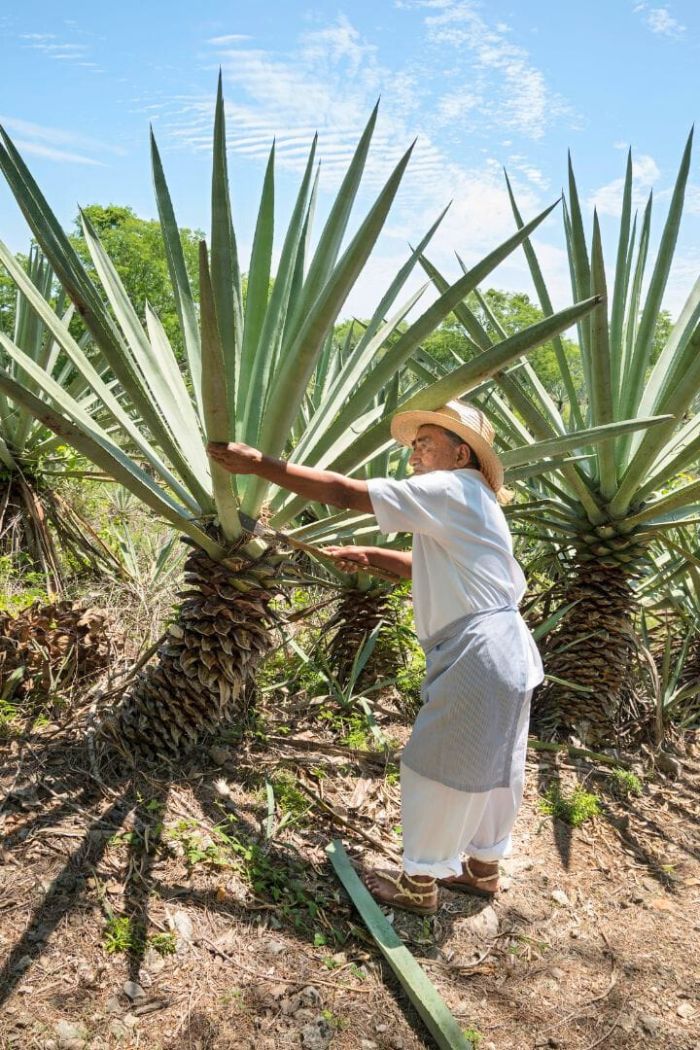
Henequen/Sisal Plant
Oro verde or green gold is generally associated with bananas, like in Ecuador. There’s even a hotel chain of the same name. Mérida, however flourished from the production of henequen. It’s an endemic plant of Yucatán, sometimes referred to as sisal, named after the original Yucatán port. The main port of Mérida moved east to Progreso, but many still refer to the plant as sisal. Henequen was known in Mexico as oro verde and was used to produce cords, fiber, hammocks, nets, ropes, sacks, string, twine and yarn.
Henequen Exported to The United States and Europe
From 1850 to 1920 Yucatán cultivated henequen and exported its fiber and products used by companies around the world. The main export destinations were Boston, Malibu, New Orleans and New York in the United States. In Europe products were exported to Antwerp, Bremen, Bordeaux, Falmouth, Hamburg, Havre, Liverpool and Marseille. Mérida had huge henequen haciendas dedicated to the production of rope. By the end of 1900 it’s been said that Mérida had more millionaires than any other city in the world. By the 1950’s, synthetic methods to produce rope related products displaced the henequen industry.
Paseo Montejo Mansions
The riches of Mérida’s golden era can be seen today. Several large, unparalleled houses decorate the lovely avenue called Paseo Montejo. Today, few of these grand buildings are used as residences by individual families. The majority of them have been renovated and are used as office buildings for banks and other businesses.
Renewed Interest in Henequen
Lately there’s been a renewed interest in this type of natural fiber. The industry is somewhat being re-born. It’s become attractive for textile designers looking for sustainable materials. Some fiber is being exported to Asia and Europe. One can still visit hacienda Sotuta de Peon, a tourist attraction close to Mérida, that shows visitors how henequen was used to produce rope. They demonstrate the entire process. It’s very interesting to see how rope was made back in the 1900’s!
Mérida Tourism
Cathedral San Ildefonso
The historic center of Mérida is known by Yucatecans as Plaza Grande. There are churches, craft stores, food stands, markets, museums, restaurants, theaters and the Universidad Autónoma de Yucatán (UADY) in the area. One of the most iconic symbols of Plaza Grande is the Catedral de San Ildefonso. It’s the oldest cathedral in Mexico and second oldest in the Americas after Santa Iglesia Catedral Basílica Metropolitana de Nuestra Señora Santa María de la Encarnación o Anunciación in Santo Domingo, Dominican Republic built in 1541. Damn that’s a mouth full! The Cathedral of San Ildefonso was built between built between 1562 and 1598, on the site of a Maya temple and was constructed using the same stones of the ancient Maya city of T’hó.
El Monumento a la Patria
El Monumento a la Patria is Mérida’s centerpiece. It was sculpted by Colombian born artist Rómulo Rozo Peña. It’s proudly displayed at the beginning of Paseo Montejo where the Paseo Montejo Prolongación begins/ends. This gorgeous sculpture sits inside a glorieta or roundabout. Most days a police car is present on the right side as you drive in from the north. Locals and tourists can be seen talking photos on the stairs of the monument. Some days the Mexican flag is hoisted high above.
Hacienda Yaxcopoil
33 kilometers (20.5 miles) southwest of Mérida, Hacienda Yaxcopoil takes you back to Yucatán’s past. This 19th-century henequen plantation, still partly operational, has a museum with old machinery and photos from its peak. The main house, with its faded elegance and antique furniture, is hauntingly beautiful. You can roam the grounds, grab a cold drink at the small café, and picture the lives of workers and landowners during Mérida’s boom years. It’s a peaceful escape from the city, perfect for a chill day trip.
Paseo Montejo is Lovely
Just a short distance from Plaza Grande lies beautiful Paseo Montejo. It’s named after Francisco de Montejo, the Spanish conquistador who founded Mérida. The riches of Mérida’s golden era can be seen today. Several large, mansions decorate the avenue. Today, few of these grand buildings are used as residences by individual families. The majority of them have been renovated and are used as office buildings for banks and other businesses. Along Paseo Montejo, one can enjoy Yucatecan food and stop for ice cream at the iconic El Colón, which has been serving locals and visitors—including famous—since 1907. You can stay at a posh boutique hotel or just take a leisurely stroll down one of the prettiest avenues in the world.
Best Places to Live in Mérida
Mérida has solidified itself as one of the best cities in Mexico for expats to live. Its fastest growing areas are in northern Mérida, which includes the colonies of Colonia Mexico, Santa Gertrudis de Copo, Sodzil Norte (I lived here), Temozón Norte, and Montes de Ame (I lived here too). Mérida continues to grow north close to highway 261 or Carretera Mérida-Progreso which takes Mérida residents to the beachside town and port of Progreso for a quick getaway. Although I’m not a fan of the humidity, I definitely consider Mérida one of the best cities in Mexico for expats to live, most likely retirees who don’t mind the sweltering weather.
Developments Outside the Periferico or “Loop” are Growing
There are numerous developments being built outside the loop of Mérida. However, many expats prefer to stay away from housing developments similar to what they’ve experienced in their home country and choose to buy historic colonial homes in the heart of Mérida and restore them to their liking. Most people would agree the best places to live in Mérida are El Centro and northern Mérida. I lived in Sodzil Norte and Montes de Ame in northern Mérida. I liked both neighborhoods.
Valladolid, Yucatán, Mexico
Valladolid, Yucatán is Special
Valladolid is a pueblo mágico in the state of Yucatán, Mexico. It’s one of the best cities I’ve ever been to. It’s technically a city, although it’s small. As of the 2020 INEGI census, Valladolid had a population of 56,494 residents. The wider municipality recorded 85,460 inhabitants. There’s no newer population figure available from INEGI beyond 2020. It’s located 42 kilometers (26 miles) from the renowned ancient Maya pyramid of Chichén Itzá. There’s also an equally impressive, yet lesser-known Maya ruin, called Ek Balam. Valladolid is 162 kilometers (100 miles) from Mérida, the capital city of Yucatán and 157 kilometers (97 miles) from the renowned resort city of Cancún in neighboring Quintana Roo. It’s basically smack dab in the middle between Cancún and Mérida. The climate in Valladolid is virtually identical to that of Mérida, meaning subtropical, very hot and humid.
La Vaquería and Jarana in Parque Francisco Cantón Rosado
La vaquería Yucateca is a popular festival that originated after the Spanish conquest (Spanish). It’s a celebration of the land and the amount of cattle the haciendas had. The festival included counting and branding the cows. The women were called vaqueras or cowgirls because they wore the same hats as the boys, or vaqueros. The party is called la vaquería. The celebration includes old Maya sounds influenced by Spanish music.
History of La Vaquería
La vaquería’s history is closely tied to the emergence of cattle product exports and the social progress of the Mestizo community in the mid 18th century in Yucatán. During this period, a blend of Spanish and Maya cultures, created unique Mestizo musical expressions. After the cattle were branded, vaqueras hosted guests and participated in lively dances with the vaqueros set to ancient Maya tunes influenced by Spanish music.
Vaqueras and Vaqueros Let Loose
Under the guidance of a master of ceremonies, participants formed two lines – one for men, the other for women. When signaled by a handkerchief, the jarana dance began. The Spanish residents of the hacienda fully engaged with the Maya in the festivities, setting aside all other activities for the duration of the vaquería.
La Jarana Dance
The jarana is the name of the dance performed during the vaquería. The jarana was originally a contest for couples to see which pair could last the longest. Toward the end when there were two couples hanging on, vying for first place, the crowd would get rowdy and divide into two camps each encouraging one of the two couples.
Performers Dance with Bottles on Their Head
The dance consists of toe tapping and the dancer’s postures are erect. They turn with their arms raised at a right angle and snap their fingers representing Spanish castanets. This upright position allows the performers to dance with liquid-filled bottles or even a tray with multiple bottles on top of their head. During the dance they try not let the bottles fall. The jarana has become the emblematic dance of the Yucatán and is performed throughout the state. If you’re able to visit Valladolid, you’re likely to catch a performance at the Parque Francisco Cantón Rosado which is the main square. In addition to Valladolid, I’ve seen the jarana performed in Mérida and Telchac Puerto.
Beautiful Outfits of La Jarana Female Dancers
The typical dress for Yucatecan women is known as a terno which is always white with the exception of the colorful embroidered flowers. It consists of three pieces: a jubón, a hipil and a fustán. The ladies’ footwear is also white. They wear a closed shoe with a strap and straight heel, practical for dancing. The women may wear rosaries around their necks, gold necklaces with medallions, gold earrings and/or other precious stones. The women put their hair up and decorate it with a ribbon and a headdress of flowers.
Jarana Male Dancers Wear Hats, Guayaberas, Red Scarfs, White Pants and Sandals
The men wear a white long-sleeved cotton shirt called a guayabera which originated in Cuba and was later brought to Mexico. They wear white straight-cut pants with front and back pockets. A sombrero, called a jipi, and a red scarf called a paliacate, is worn in the waistband of the pants and hangs down past the knee. The men’s shoes, called chillonas, are a type of cowhide leather sandal. They have a thick high heel that emits a small squeal when dancing, thus receiving its name chillona.
Valladolid, Yucatán and its Cenotes
Valladolid is surrounded by numerous cenotes, which are natural pools created by the Chicxulub crater. The crater is the result of an asteroid or comet 11 to 81 kilometers (6.8 to 50.3 miles) in diameter that collided with earth roughly 66 million years ago. It’s 150 kilometers (93 miles) in diameter and 20 kilometers (12 miles) in depth. It’s named after the Yucatecan town that lies near the center of the crater. Scientists widely considered it the cause of the Cretaceous-Paleogene extinction event, in which 75% of plant and animal species on Earth became extinct, including all non-avian dinosaurs.
Notable Cenotes Surrounding Valladolid
- Ik Kil (often overcrowded with tourists)
- Oxman (My favorite, located in Hacienda San Lorenzo with a rope swing!)
- Suytun (famous for its amazing Instragrammable photos on its man-made platform)
- Saamal (located in Hacienda Selva Maya where you can jump off a platform!)
- Samulá and X’keken (both good, both at the same location, also known as “Dzitnup”)
- Zací (Not the greatest cenote but located in the very heart of Valladolid)
Uxmal, Yucatán, Mexico
Mexico City, Mexico (CDMX)
Uxmal, Yucatán, Important Maya Site
Uxmal gets overlooked by Chichen Itza. I had a much better time in Uxmal and found it to be more interesting. The Pucc Region ranges from northern Campeche to western Quintana Roo. Ironically, the word Pucc means hill in Maya and the entire state of Yucatán is flat with the highest point found in a small town called Muna which is only 40 meters (131 feet) above sea level. Pucc is an area of several Maya archaeological sites that share a similar architectural style. Uxmal is the most well-known town in the Pucc Region. Incidentally, the world-famous Maya site of Chichen Itza isn’t part of the Pucc region.
Upgraded Architecture Yet Built in a Place Lacking Water
Facades in Uxmal and other locations in the Pucc region were built with precisely cut veneer stones set into a concrete core. This architectural style was an upgrade to the previous Maya method of setting large stones above one another using lime mud as mortar. Uxmal is located 90 kilometers (55 miles) southwest of Mérida, the capital of Yucatán. Uxmal is one of the most important archaeological sites of the Maya, along with, Chichen Itza, Calakmul and Palenque in Chiapas, Caracol and Xunantunich in Belize, and Tikal in Guatemala. It’s a mystery why the Maya built a settlement in a place without rivers or water sources. This conundrum underscores their devotion to Chaac, the rain god, which is symbolized in several of Uxmal’s structures.
Uxmal is Definitely Worth Visiting
I found Uxmal to be less touristy and more interesting than Chichén Itzá. I had a such a good time. Uxmal is open 7 days a week from 8:00 AM to 5:00 PM. I suggest going early morning or a bit later in the afternoon as Uxmal and the Yucatán in general can reach extremely hot temperatures with suffocating humidity. As of the date of writing this, foreign visitors can pay $338.00 MXN ($15 USD), while Mexican citizens or residents will pay $101 MXN ($4.50 USD). After paying the entrance fee, one will walk a short distance and lay their eyes upon the beautiful Adivino (aka, the Pyramid of the Magician or Pyramid of the Dwarf). This pyramid is stunning and unusual in that it was constructed in an elliptical; almost egg shape, instead of the more common block style structures the Maya built. It’s extremely well preserved.
Uxmal “Pok ta Pok” Ball Court aka Pitz, Pelota Maya
Not far from the Adivino is a Mesoamerican ball court with an alley and slanted walls on each side that was used to play pok ta pok (or pok-a-tok), which according to Wikipedia was the name given by Danish archaeologist Frans Blom, who adapted it from the Yucatec Maya word pokolpok in a 1932 article. The Maya originally called the game pitz. In Spanish it’s commonly referred to as juego de pelota Maya or simply pelota Maya. It was originally played with a hard, heavy rubber ball. It was also played in one version or another the Toltecs and the Aztecs, which they called ōllamaliztli and currently refer to as ulama.
Indigenous Groups Play Various Versions of Pok ta Pok
The game is still played by indigenous cultures. It’s believed that the object of the original game was to keep the ball in play, in the boundaries of the court, similar to volleyball without a net and players would use the slanted walls to pass the ball to the opponent on the other side of the court. Some versions only allowed the hip to strike the ball, while other versions included some type of bat, racquet or stick and/or allowed the use of the forearm.
Hoops Anyone?
In the Postclassic period (900–1521 AD) the Maya began playing the game with stone hoops on each side of the court with the objective being to pass the ball through the ring, somewhat similar to basketball. This innovation to the game spread to the Aztec and Toltec. The game was played mostly for recreation although the serious games included human sacrifice. This court in Uxmal is rather deteriorated.
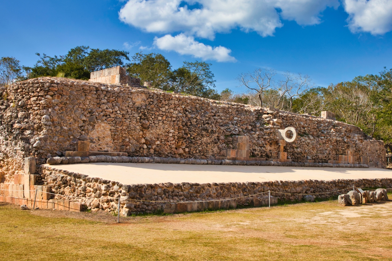
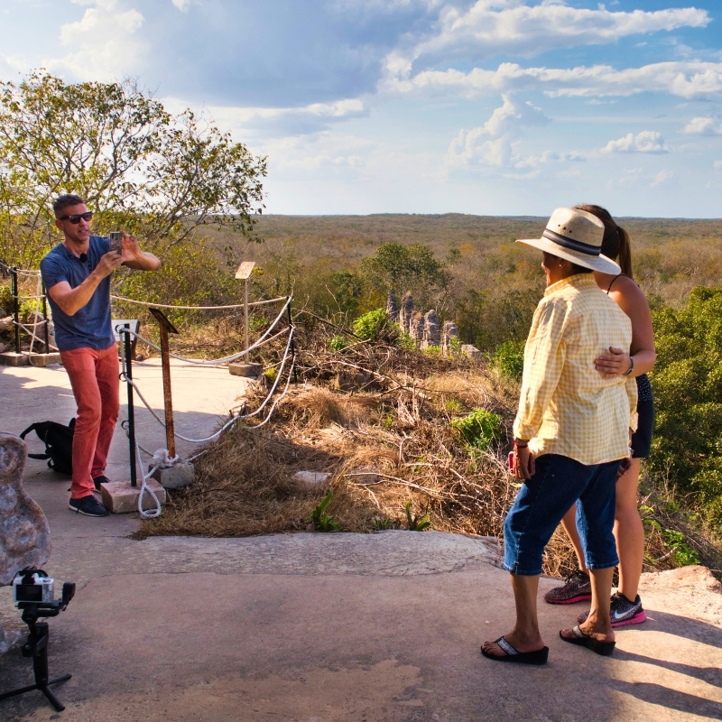
Templo Mayor Rises Out of the Lush Jungle
A stroll away from the ball court stands the Grand Pyramid or Templo Mayor. This impressive 30-meter (100 foot) structure is popular among tourists because, unlike Chichen Itza, visitors are allowed to climb the pyramid. Once on top, there is a great view of the 91.44 meter (300 foot) long Governer’s Palace or Palacio del Gobernador, some other structures off in the distance, and the surrounding, seemingly untouched jungle.
Cuadrángulo de las Monjas
Another popular structure is the Nuns’ Quadrangle or Cuadrángulo de las Monjas. It’s comprised of four buildings; South Building, North Building, East Building and West Building, that were built on a platform. It’s believed by many that The Quadrangle of the Nuns was utilized by the Maya for administrative meetings and decisions.
Querétaro, Qro, Mexico
Querétaro, Ideal for:
- The young couple
- The older, single person
- The social security retirees (singles or couples)
Santiago de Querétaro
Santiago de Querétaro commonly known as just “Querétaro” is the capital of the state of Querétaro. It lies 221 kilometers (137 miles) northwest of Mexico City in the Bajío region. Querétaro sits at an elevation of 1,820 meters (5,970 feet). The Querétaro Metropolitan Area is the tenth most populated in Mexico with 1,049,777 residents according to Data Mexico (2020) (Spanish).
Querétaro Climate
Querétaro’s climate is subtropical highland (Köppen Cwa), with average daily temperatures of 18-22°C (64-72°F). The dry season, from October to April, brings sunny, mild days with low humidity. The rainy season, from May to September, sees moderate showers with moderate humidity. Many people, like me, that dislike extreme heat and humidity, believe that Querétaro has near perfect weather. I moved to Querétaro in 2024.
Querétaro Crime
Crime in Querétaro, mainly robbery and domestic violence, is lower than many Mexican cities, with 25,896 cases reported in 2023, according to INEGI. The homicide rate was 8.36 per 100,000, far below Mexico’s average of 24.9. In 2025, 39.8% of locals felt unsafe, according to INEGI. Juriquilla and Zibatá, two affluent communities north of El Centro, are very safe. Juriquilla, developed in the 1970s with luxury homes and condominiums, features the iconic Juriquilla Towers in the Santa Fe residential area. Zibatá, a residential community with double—and sometimes triple—ring security is renowned for its family friendly atmosphere. Every vehicle passes at least one checkpoint before entering. Once inside you’ll find green spaces built around shallow ponds, along with casual dining, and small shops. Zibatá is home to Universidad Anáhuac Querétaro campus.
Querétaro is Growing Rapidly
Querétaro has experienced growth in recent years. Querétaro’s economy is tied to manufacturing, especially machinery for the aerospace and automotive industry. Although cars are not assembled in Querétaro, the fabrication of auto parts is big. Querétaro also makes chemicals such as adhesives, paint and rubber products. There are lots of Asians that work in Querétaro. The Fujitaya hotel is an authentic Japanese hotel in Juriquilla. I stayed for a couple weeks and can highly recommend it.
Querétaro Transportation
Querétaro International Airport (QRO)
Querétaro International Airport (QRO) aka Ingeniero Fernando Espinoza Gutiérrez International Airport is located 34 kilometers (21 miles) northeast of downtown Querétaro. In 2024, passenger traffic totaled 1.6 million. 6 international direct flights depart to the United States, along with 8 domestic routes. QRO serves 6 airlines from Mexico and the US.
Local Buses and Colectivos
Local buses in Querétaro operate under the QroBús system. Routes connect Centro Histórico, El Refugio, Juriquilla, Milenio III, and other neighborhoods. QroBús uses modern, air-conditioned buses that only accept payment via a rechargeable smart card—no cash. The card can be bought and reloaded at Oxxo stores, QroBús service modules, vending machines at key stops, and some CETRAM locations. The QroBús app can be used to view your balance and locate spots to reload your card, but it doesn’t support adding funds digitally. Colectivos run along Avenida 5 de Febrero, Boulevard Bernardo Quintana, and Highway 57. They serve areas like Corregidora, El Centro, El Marqués, Jurica, Juriquilla, San Juan del Río, and Zibatá.
Regional Buses
For regional travel, ETN and Primera Plus are the 2 major bus companies with service at Querétaro’s Terminal de Autobuses, located at Acceso a La Central, Terminal de Autobuses, 76063—4.2 kilometers (2.6 miles) southeast of El Centro Histórico. Check out information about each company, including classes of service and the destinations they serve.
Taxis, Rideshares, and Rentals
There’s an authorized airport shuttle stand right outside the airport. It’s the best way to get into the city quickly. I’ve used it several times and I’m an “Uber guy”. However, most flights arrive late at night and the airport shuttle is the most convenient way to get out and be on your way. Cars can be rented from Alamo, Avis, Budget, Enterprise, Hertz, National, and Thrifty at the airport. In Querétaro proper there are many more car rental agencies to choose from. Local taxis don’t use meters, so confirm fares upfront. Didi, InDrive, and Uber rideshares are available.
Querétaro Tourism
Acueducto de Querétaro
One of the most impressive well-known symbols of Querétaro is the Aqueduct. It stretches 1.78 kilometers (1.11 miles) along what is now Avenida Zaragoza. One end of the structure lies in one of the hills surrounding the El Centro. The Aqueduct has an average height of 28.5 meters (94 feet) and is made of stone. The structure has 74 semicircular arches and is still used today to flow water to dozens of fountains throughout Querétaro. Nowadays cafés and trendy restaurants can be found at its base. I had a blast driving up and down along the Aqueduct. Check out my trip below.
El Centro Histórico
Querétaro is not internationally recognized as a tourist destination, but it should be. In 1996 UNESCO declared The Querétaro Historic Monuments Zone a World Cultural Heritage Site. Take a stroll around Plaza de Armas, Jardín Zenea, or Plaza de la Independencia—all surrounded by cafés, eateries, fine dining, and shops. Visit Templo de San Francisco with its orange dome, or Templo de Santa Rosa de Viterbo, a baroque masterpiece. Teatro de la República is where Mexico’s 1917 Constitution was signed—an event that solidified Mexico as a sovereign republic and laid the foundation for its modern legal system. Museo Regional de Querétaro showcases the area’s history. Cerro de las Campanas, a historic hill just outside the center, is where Emperor Maximilian of Austria—appointed by the French as Mexico’s last emperor—was executed on June 19, 1867, following a brief trial in Querétaro.
Mirador de Los Arcos
Mirador de los Arcos, on Cerro del Sangremal, overlooks Querétaro’s Aqueduct and skyline. It’s a 10-minute drive from El Centro or a short hike up the hill. You can park for free and snap a few Instagram worthy shots with the 74 arches of the Aqueduct in the background, especially at sunset. Locals and visitors gather to take in the view. When I visited, there was a Las Vegas Raiders party on gameday before kickoff. There’s lots of Raiders fans in Mexico.
Bernal and Tequis
Take a trip to a couple pueblos mágicos outside of Querétaro. Tequisquiapan, affectionately known as “Tequis,” is a charming tranquil town with good weather throughout the year. There are several hot springs and spas in and around Tequisquiapan—great for a weekend getaway. It holds the Cheese and Wine Fair each October. I visited in 2025 with my best friend Dani and had a wonderful time. We took the trolly tour around town which was a lot of fun. Tequis is located about 64 kilometers (40 miles) east of El Centro Histórico. On the way back, we saw Peña de Bernal off in the distance and decided to check it out. It’s a massive rock formation often cited as the third largest monolith in the world, located in San Sebastián Bernal, more widely known as just “Bernal”. It stands 433 meters tall and was named a UNESCO Intangible Cultural Heritage in 2009. Bernal is about 60 kilometers (37 miles) northeast of El Centro Histórico. If you go to Tequis, you might as well check out Bernal. Primera Plus buses to Bernal and Tequis depart from the main Terminal de Autobuses, located at Acceso a La Central, Terminal de Autobuses, 76063, 4.2 kilometers (2.6 miles) southeast of El Centro Histórico.
Querétaro Best Places to Live
Querétaro is among the best cities in Mexico for expats. It may lack the nightlife important to young digital nomads but will appeal to many others. Many nationals and foreigners alike have chosen Querétaro to live. People choose the city for its moderate climate, modernity and security. Neighborhoods like Juriquilla, where I live, feature upscale gated communities, the iconic Juriquilla Towers, UNAM’s campus, and the world-class Antea mall, just a minute or two south on highway 57 in Jurica, making it perfect for professionals and families. Zibatá is known for its double and even triple ring security, family-friendly housing, a golf course, and green spaces. Zibatá is ideal for families, especially those with children. Álamos, one of Querétaro’s first residential areas, retains its enduring charm with quiet, tree-lined streets and proximity to the historic center. Cumbres del Lago, near Juriquilla, has breathtaking hilltop lake views in a secure residential area.
Tequisquiapan, Querétaro
Tequisquiapan, locally known as Tequis, is a charming, colorful pueblo mágico located 64 kilometers (39 miles) east of Querétaro. Tequisquiapan is known for its tranquility and good weather throughout the year. There are several hot springs and spas in and around Tequisquiapan; great for a weekend getaway. It’s a great place for wine and cheese lovers. Tequisquiapan holds the Cheese and Wine Fair (Spanish) that takes place in October. I had a wonderful time visiting Tequis with my best friend Dani.
Peña de Bernal, Querétaro
Peña de Bernal, in San Sebastián Bernal, Querétaro, Mexico, is a massive rock formation, often cited as the third largest monolith globally, after the Rock of Gibraltar and Sugarloaf Mountain in Brazil. Standing 433 meters tall with an altitude of 2,510 meters. It was named a UNESCO Intangible Cultural Heritage in 2009. I visited just before sunset on our way back from Tequis. If you go to Tequis you might as well check out Bernal. We saw it on the way home, off in the distance and decided to check it out.
Riviera Maya, Quintana Roo, Mexico
Cities and Towns of Riviera Maya, Mexico
Riviera Maya is a region located in southeastern Mexico along the Caribbean Sea in the state of Quintana Roo. Cancún isn’t considered part of Riviera Maya. Riviera Maya begins about 36.2 kilometers (22.5 miles) south of Cancún in Puerto Morelos, although there is talk about including Cancún and perhaps even Isla Mujeres in the Riviera Maya zone. Traditionally, the cities and towns that make up the Riviera Maya from north to south are:
- Puerto Morelos
- Tres Ríos
- Playa del Carmen
- Xcaret (Popular man-made theme park)
- Paamul
- Puerto Aventuras
- Xpu Há
- Akumal
- Xel-Há (Popular man-made theme park)
- Bahía de Punta
- Soliman
- Tankah
- Tulum
- Boca Paila
- Punta Allen
Mesoamerican Barrier Reef System
The main attraction of the Riviera Maya is its beautiful beaches that are enclosed with the Mesoamerican Barrier Reef System, the fourth largest on earth after The Great Barrier Reef, Red Sea Coral Reef and New Caledonia Barrier Reef. The Mesoamerican Barrier Reef is listed on other sites as the second largest in the world. That information seems to be incorrect. Regardless, the Mesoamerican Barrier Reef System is the largest in the Western Hemisphere and stretches from Isla Contoy at the northern tip of the Yucatán Peninsula south through Belize, Guatemala and the Bay Islands of Honduras.
Climate in the Riviera Maya
The days are typically hot and humid as is true for the entire Yucatán Peninsula, although you can catch an ocean breeze if you’re in the right spot. The average temperature is 25° C (77° F). December through March, temperatures remain warm with a maximum of 35 ° C (77 ° F) and 15° C (60° F) at night. The rainy season is from May to November; the dry season is from December to April.
Riviera Maya’s Crystal-Clear Turquoise Water
Riviera Maya’s beaches and fine white sand make it an attractive place for tourists and residents. Most people agree that the best beaches in Mexico are on the Riviera Maya, me included. However, places like Cancún and Playa del Carmen lack authentic Mexican culture and are more geared toward short stay tourists that like to party which isn’t my thing. The walking “Hey my friend” salesmen can wear on you pretty quick. Cancún International Airport serves as the gateway to the Riviera Maya, receiving over 20 million tourists annually. According to Forbes México, the Riviera Maya attracts as many international visitors as Brazil and Argentina. Tourists flock to the Riviera Maya for its pristine beaches, iconic Xcaret and Xel-Há theme parks, and ancient Maya ruins like Tulum and Cobá.
Cancún, Quintana Roo, Mexico
Cancún, Quintana Roo
Cancún, Ideal for:
- The young, single digital nomad
- The young couple
- The older, single person
- The rich of any age
Cancún, King of Vacay
Cancún, also known locally as Benito Juárez, is the most inhabited city in the state of Quintana Roo with a population of it 934,189 according to Data Mexico (Spanish). Cancún is the most recognized Mexican tourist destination in the world. Everything in Cancún revolves around tourism. The Cancún International Airport is the second busiest in México. In 2023, Cancún International Airport handled 32.75 million passengers, a substantial increase from the 26 million in 2019. The airport saw a record-breaking 3 million passengers in December 2023 alone.
Cancún Climate
Cancún’s climate is tropical monsoon (Köppen Am), with average daily temperatures of 27-31°C (81-88°F). The dry season, from November to April, brings sunny, warm days with moderate humidity. The rainy season, from May to October, sees heavy showers with high humidity. Its coastal location allows slightly lower temperatures compared to inland Yucatán cities like Mérida and Valladolid. Cancún’s climate is virtually identical to Playa del Carmen and Tulum due to their proximity.
Cancún Crime
Crime in Cancún, mainly robbery and domestic violence, impacts residents more than tourists, with 12,307 cases reported in 2023, according to INEGI. The homicide rate reached 64.4 per 100,000, exceeding Mexico’s average. In 2025, 79.5% of locals felt unsafe, according to INEGI. Still, millions visit Riviera Maya annually, enjoying its attractions safely.
Cancún Transportation
Cancún International Airport (CUN)
Cancún International Airport (CUN) aka Aeropuerto Internacional de Cancún is located 16 kilometers (9.9 miles) southwest of downtown Cancún. In 2024, passenger traffic totaled 30.6 million. 95 international direct flights depart to the United States, Canada, Europe, and Latin America/Caribbean, along with 31 domestic routes. CUN serves 47 airlines from the US, Canada, Mexico, UK, Germany, France, Spain, Netherlands, Colombia, Cuba, Argentina, Brazil, Portugal, and Switzerland. Cancún is the gateway to the Riviera Maya.
Local Buses and Colectivos
Cancún’s local bus network is run by several operators: Autocar, Bonfil, Maya Caribe, Turicún, and TTE, covering urban routes—including the Hotel Zone (R-1/R-2), downtown, and airport corridors 24/7. These buses can be hailed anywhere and stop upon request. ADO also runs frequent shuttle-style service between the airport and downtown or hotel areas. While ADO is well known for its regional routes, in Cancún and the Riviera Maya it also functions as local transit. Colectivos run along Highway 307 toward Akumal, Playa del Carmen, Puerto Aventuras, and Tulum.
Regional Buses
ADO runs regional service from Cancún to cities throughout the Yucatán Peninsula, including Bacalar, Campeche, Chetumal, Mérida, Playa del Carmen, Tulum and Valladolid. All buses, regardless of class, have air conditioning. Cancún has two main terminals: Cancún International Airport (outside Terminals 1–4) and the downtown terminal on Calle Pino. ADO also provides short-distance trips like Playa del Carmen and Tulum. See below for more information about ADO, the different class levels of service, and their destinations. I’m a big fan.
Taxis, Rideshares, and Rentals
Local taxis in Cancún don’t use meters, so confirm fares upfront to avoid overcharges. Taxis serve downtown, Puerto Cancún, and the Zona Hotelera. Uber works downtown but isn’t recommended at the airport or Zona Hotelera due to violent opposition from taxi unions, including driver assaults. Cars can be rented from Alamo, America Car Rental, Avis, Budget, Enterprise, and Hertz at Cancún International Airport. Private shuttles, like Cancún Airport Transportation, available right at the airport, provide direct rides to hotels in Cancún, Playa del Carmen, and Tulum. Shared shuttles are also available at a lower cost but with stops along the way.
Cancún Tourism
Coco Bongo Night Club
Coco Bongo, known as “Where Las Vegas Meets Mexico”, is Cancún’s most recognized acrobatic themed nightclub. The club’s history is interesting. The 1994 film, The Mask, featured a club located in Cancún called Coco Bongo. However, the club didn’t exist at that time. Roberto Noble, however, did indeed open a club in Cancún and named it after the club in the movie. Hence, the real Coco Bongo opened 3 years after the movie in 1997. It’s quite impressive for any club to be open for almost 30 years and even more impressive that they’ve expanded to other locations. They currently have clubs in Cancún, Playa del Carmen, Los Cabos on the west coast of Mexico and Punta Cana in the Dominican Republic.
Puerto Cancún
Marina Town Center attracts tourists with its dining and shopping along the port in Puerto Cancún. Upscale restaurants like Cantina La 20, Cenacolo, and Montemar serve Mexican, Italian, and contemporary cuisine. Marina Town Center also has some casual favorites like Aldo’s (ice cream), Mars Burgers, and Starbucks. The open-air mall showcases today’s most sought-after brands. This quieter corner of Zona Hotelera blends fine and casual dining along a scenic waterfront. Sunset cruises and yacht charters to Isla Mujeres depart from the port.
Zona Hotelera is Where It’s At
The Hotel Zone or Zona Hotelera is 26 kilometers (16.1 miles) long. It’s full of bars, clubs, resort hotels, restaurants and shopping. The Hotel Zone also offers residential properties with luxury amenities. Many foreigners choose to live part time or full time in Cancún. Nightlife can be found in the heart of the Hotel Zone in an area known as Punta Cancún, home to the famous red and white striped lighthouse with a spiral staircase located behind the luxurious all-inclusive beachfront resort, Hyatt Ziva. I was lucky enough to stay there for a couple days with my daughter. Man, what a hotel.
Cancún Best Places to Live
Zona Hotelera
Zona Hotelera stretches 22 kilometers along the Caribbean and is home to high-end condos and beachfront houses in areas like Kukulcán Boulevard, Punta Cancún, and Punta Nizuc. Rentals range from 30,000 to 250,000 MXN per month, with properties selling for up to 7,000,000 USD. Residents tend to choose the area for direct beach access, stunning turquoise sea views, gated complexes, and proximity to golf courses and marinas. Punta Nizuc offers more privacy and quieter surroundings, while Punta Cancún is busier and closer to commercial zones. The cost of living is high, and the constant tourism means no neighborhood feel, but for some, the Caribbean setting outweighs those trade-offs.
Puerto Cancún
Puerto Cancún is a gated community at the north end of the Hotel Zone, known for high-end developments like Isola del Sol, Marina Town Center, and SLS Harbour. Condos rent for 30,000 to 900,000 MXN per month, with sale prices starting around 800,000 USD. Residents are drawn to the marina views, 18-hole golf course, and quick access to downtown. Many of the residential towers include upscale features like concierge service, gyms, pools, and spas. It’s quieter than Zona Hotelera, with little tourist traffic, but the exclusivity and high costs limit who can live here.
Avenida Huayacán
Developments on Avenida Huayacán, are known for bike lanes, pools, gyms, and 24/7 security. Condos and townhomes rent for 12,250 to 30,000 MXN per month, with sale prices ranging from 150,000 to 400,000 USD. Arbolada del Sur appeals with pet parks and extensive green spaces. Valle del Sur stands out with a climbing wall, coworking space, and skatepark. Zelva 44 Cancún features paddle courts and jogging paths. Residential communities on Huayacán, including others like Cumbres Residencial and Ombú, balance modern amenities and security without the waterfront price.
Cozumel, Quintana Roo, Mexico
Cozumel Ferry to and from Playa del Carmen
Cozumel is an island located in the Mexican Caribbean. It takes about an hour to reach Cozumel by ferry from Playa del Carmen (“PDC”). It lies 19.3 kilometers (11.99 miles) from PDC. Cozumel also has its own international airport. It’s the third largest island in Mexico after Isla del Tiburón in the state of Sonora and Isla Ángel de la Guarda in Baja California. The distance from north to south is 48 kilometers (29 miles) and from east to west it is 14.8 kilometers (9.3 miles). Cozumel has a population of 88,626 according to Data Mexico (2020).
Cozumel, Cruise Ships Favorite Port of Call
The picturesque island has long been a favored port of call for cruise ships. It seems like every cruise line has Cozumel on its itinerary. Renowned for its coral reefs and crystal-clear waters, Cozumel is a haven for snorkeling enthusiasts. The island’s lively marine life, including colorful fish and intricate coral formations, attracts travelers from around the world seeking underwater adventures. It’s warm climate, inviting beaches, and plethora of snorkeling opportunities enchant cruise passengers.
Cozumel Impressive Numbers
Cozumel handled 4,642,987 cruise passengers across 1,281 ship arrivals in 2024, a 13% increase from 2023’s 4.1 million, per a press release from the Quintana Roo Tourism Secretariat (SEDETUR). Tourists arrived on cruise lines from Carnival, Celebrity Cruises, Disney Cruise Line, MSC Cruises, Norwegian Cruise Line, Princess Cruises, and Royal Caribbean. By several accounts, Cozumel is the 3rd busiest port of call behind Miami and Nassau.
Playa del Carmen, Quintana Roo, Mexico
Playa del Carmen, Ideal for:
- The young, single digital nomad
- The young couple
- The older, single person
- The social security retirees (singles or couples)
- The rich of any age
Playa del Carmen Keeps on Growing
Playa del Carmen, locally known as simply Playa and abbreviated PDC is located 68.2 kilometers (42 miles) south of Cancún and about 19.3 kilometers (12 miles) west of the island of Cozumel. Ferry rides, lasting about an hour, shuffle travelers back and forth between Playa del Carmen and Cozumel. Playa del Carmen is 68 kilometers (42 miles) north of Tulum along Mexico’s Riviera Maya. The once sleepy fishing village has seen phenomenal growth in the last 30 years and it’s not slowing down. Unbelievable to imagine, Playa del Carmen had only 17,621 residents back in 1995 and only 43,613 in at the turn of the century. The 2020 census put the population of Playa del Carmen at 304,942 (Spanish). More recent estimates from 2024 suggest a range of 323,098 to 368,698. That’s unprecedented growth for any city.
Condo Development Growth in Playa
If you visit Playa del Carmen, you’ll quickly notice there are people from “everywhere”. Apart from the locals, you’ll come across Americans, Argentinians, Brazilians, Canadians, Colombians, Europeans, Venezuelans and more. This demand has spurred rapid condo development, which is limited to 5 stories. Due to these restrictions, PDC continues to spread out.
Playa del Carmen Climate
Playa del Carmen’s climate is tropical monsoon (Köppen Am), with average daily temperatures of 27-31°C (81-88°F). The dry season, from November to April, brings sunny, warm days with moderate humidity. The rainy season, from May to October, sees heavy showers with high humidity. Its coastal location allows slightly lower temperatures compared to inland Yucatán cities like Mérida and Valladolid. Playa del Carmen’s climate is virtually identical to Cancún and Tulum due to their proximity.
Playa del Carmen Crime
Playa del Carmen reported 4,100 criminal incidents per 100,000 residents in 2024, according to INEGI. Homicides, often tied to organized crime, reached 16.2 per 100,000. Robbery and home burglaries are a concern, with rates of 190 and 220 per 100,000. Avoid Colosio and Ejidal after dark. That said, many locals and tourists say they feel safe walking around during the day—and some even at night—especially in central and tourist areas, including the west side of Carretera Federal 307. In late 2023, the city added police checkpoints with K9 units and plate readers, followed by a 2024 rollout of more surveillance cameras and specialized units targeting extortion and property crime.
Cruise Ship Tourists in Cozumel Visit PDC
Playa del Carmen has luxurious, five-star, all-inclusive hotels as well as more moderately priced hotels including boutique style lodging. Previous to the Corona Virus outbreak, Playa del Carmen received loads of tourists each day that took the ferry from Cozumel, situated just 12 miles off the coast.
Annoying Street Vendors Are Relentless
Unfortunately, La Quinta is full of annoying street vendors trying to sell anything and everything, from costume jewelry, knickknacks, marijuana (you may be approached discreetly to buy some weed, coke or whatever). More than anything you’ll be bombarded by tour and restaurant vendors. Whether the tourists drive down from Cancún or come over on the ferry from Cozumel, the vendors prey on them ferociously. It’s understandable that they’re just trying to make a living. Nonetheless hearing “Hey my friend…” every 5 seconds sucks. After a while one gets used to it and just keeps walking. Street vendors aside, La Quinta is a great avenue. It’s a lot of fun to walk. There’s a lot to see and it’s perfectly located just behind Playa’s beautiful beaches, assuming PDC’s shores aren’t full of sargassum.
Playa del Carmen Transportation
Cancún International Airport (CUN)
Playa del Carmen, 55 kilometers (34 miles) south of Cancún International Airport (CUN), relies on CUN for air travel. CUN served 32.7 million passengers in 2023. 95 international direct flights depart to 24 countries, along with 31 direct domestic routes. Cancún serves 47 airlines from 14 countries. Its airport connects Playa del Carmen to the world.
Ferry to Cozumel
Ferries to Cozumel depart nearly hourly from Terminal Marítima right off Quinta Avenida. It’s just a 220-meter (722 feet), 3-minute walk from the ADO bus terminal on Quinta Avenida and Benito Juarez. Ultramar (ultramarferry.com) and Winjet (winjet.mx) run boats with open-air decks and air-conditioned seating. Rides can be a bit choppy crossing to Cozumel’s San Miguel pier and take 45 minutes to an hour. Ultramar has better ratings on Google Maps. Ultramar tickets can be bought via app, kiosks or website. Winjet tickets can be bought via website and kiosks.
Take Car, Motorcycle/Scooter to Cozumel
If you want to take a vehicle including a motorcycle/scooter the name of the terminal is referred to as Punta Venado (Calica) and is 11 kilometers (6.8 miles) south of the passenger only ferry. Ultramar will redirect you to Ultracarga (ultracarga.com), although “motorcycle/scooter” wasn’t an option in the dropdown list of vehicles when I checked, just different sized cars and car brands. It is however listed in the “Rutas” menu item. It costs 360 MXN for moto plus driver (2025). Ultracarga departs twice a day. It’d be best to contact them directly. Winjet, on the other hand, will redirect you to Transcaribe (transcaribe.net). Although they do have a clear “Motocicletas dos ruedas” button, their calendar wouldn’t allow me to change dates, and automatically inserted tomorrow’s date. I consistently received a “No tenemos disponibilidad para esa fecha, por favor seleccione otra”. Therefore, I couldn’t check the price. Again, it’s best to contact them directly. Transcaribe departs 3 times per day. Both websites are a bit sus.
Local Buses and Colectivos
Urban buses from Autocar and Maya Caribe serve the area around Centro Maya, nearby neighborhoods, Quinta Avenida, and a few blocks from Playa Mamitas. Colectivos connect Playa del Carmen to Akumal, Cancún, Puerto Aventuras, and Tulum via Highway 307. Departing every 15–20 minutes, they take off from the stop at Calle 2 Norte & Avenida 15 and the one at Avenida 25 & Calle Juárez but can also be hailed roadside. They run 24/7 and take cash only.
Regional Buses
ADO runs regional service from Playa del Carmen to cities throughout Mexico. In the Yucatán Peninsula, they go to Bacalar, Campeche, Cancún, Chetumal, Mérida, Tulum and Valladolid. Playa has two main terminals: Terminal Turística on Quinta Avenida between Calle 12 and Calle 14, and Terminal Alterna at Avenida 20 and Calle 12. They also serve short-distance trips like Cancún and Tulum. Learn more about ADO, the different class levels they offer, and destinations served throughout Mexico.
Taxis, Rideshares, and Rentals
Local taxis in Playa del Carmen don’t use meters, so confirm fares upfront. Rideshare apps like Uber are unreliable due to violent opposition from taxi unions, including driver assaults. Cars can be rented from America Car Rental, Avis, Enterprise, Hertz, MEX Rent-A-Car, and National in Centro. Scooter rentals from iBike Playa, Ola Scooter Rental, and Scoot Playa are a great way to get around PDC. Radio Taxi PDC has an app where users can see fares upfront and book rides.
Playa del Carmen Tourism
Cenote Dos Ojos
Cenote Dos Ojos, 50 kilometers (31 miles) south of Playa del Carmen on Carretera Federal 307, are two sinkholes linked by underwater caves—hence the “two eyes.” The Maya viewed cenotes as sacred entrances to the underworld and used them for ceremonies, including occasional offerings and sacrifices. The cenote is fun to snorkel, with a deeper, darker “bat-cave” section reachable through a submerged tunnel. The water is extremely clear and stays cool at 24-25 °C. Depth ranges from 6-10 meters (20-33 feet) in recreational zones and gets deeper in cave passages. Lockers and showers are on site. There’s also a small restaurant near the entrance. Colectivos (passenger vans) can drop you off and pick you up near the entrance.
La Quinta
Quinta Avenida, a 22-block pedestrian-only street parallel to the beach, is Playa del Carmen’s main attraction. It’s the place to see and be seen. Bars, pharmacies, restaurants, and shops line the strip. Argentinian steakhouses, Brazilian rodizios, burger joints, fast food chains, Italian trattorias, Japanese sushi bars, Mexican taquerias, and pizzerias offer mega-diverse dining options. A 5-minute walk east from the ADO bus station on Avenida 20 brings you past Coco Bongos nightclub and Porfirio’s restaurant to Quinta Avenida with the Caribbean Sea behind it.
Mamitas Beach
Mamitas Beach, right off Quinta Avenida, is always happening. There’s a beach club aptly named Mamita’s Beach Club right there. Lounging around, just chillin’ seems to be the thing to do. It’s a great place to people-watch. Playa Mamitas attracts locals and tourists with its sandy beach, music, and Caribbean vibe. The Riviera Maya Jazz Festival, held in November or early December, draws 50,000 plus annually.
Xcaret Park
Xcaret Park, 10 kilometers (6.2 miles) south of Playa del Carmen on Carretera Federal 307, highlights the natural splendor and wonder of the Riviera Maya. Visitors can check out endemic wildlife like the jaguar, a highly revered animal known as “ba’lam” by the Maya, explore Maya ruins, or snorkel underground rivers. The Xcaret México Espectacular show captivates with 300 performers in colorful costumes. Food spots dot the park for all-day visits.
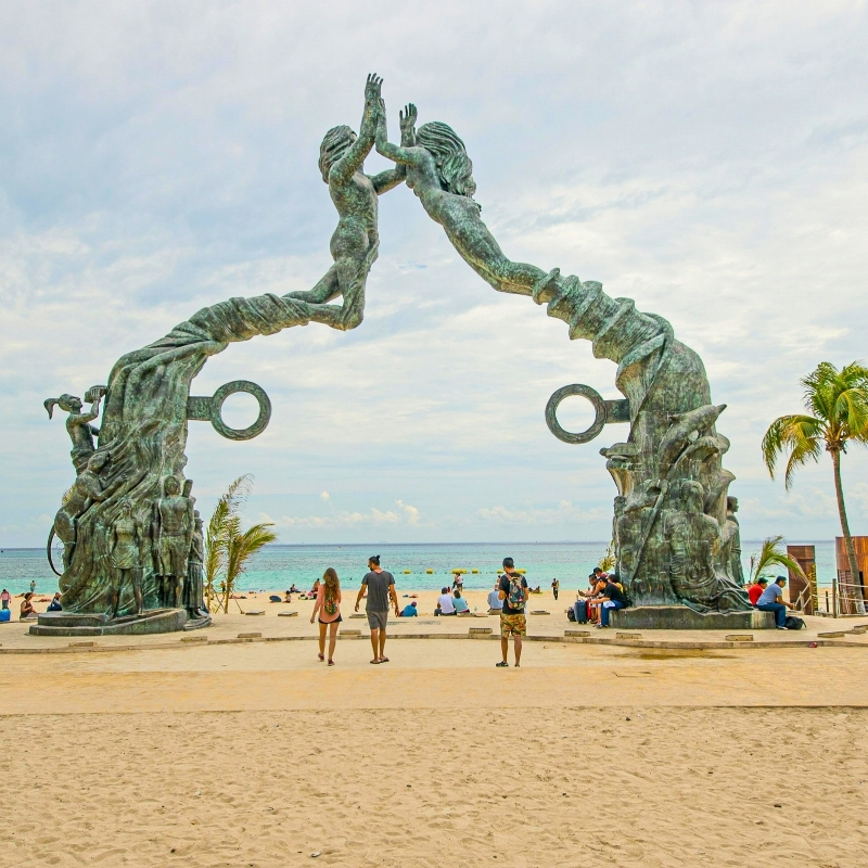
Portal Maya 2012
By far, Playa del Carmen’s most iconic landmark is the Portal Maya or more officially, Portal Maya 2012 which was placed in front of the beach at Parque Fundadores in late 2011. It commemorates the Maya calendar and the date of December 21st, 2012, when it was prophesized that the world would come to an end and a new era would begin. Fortunately, the calendar was incorrect. Understandably, some people mistake or interpret the sculpture for two mermaids rising out of the ocean in embrace.
Portal Maya Depicts Two Players Playing Pok ta Pok
The statue displays two bronze figures, a man and women that stand up and embrace hands. Each side of the arched statue features a hoop, referencing a game that goes by many names including pitz, pok ta pok (or pok-a-tok), derived from the Maya word pokolpok.
Voladores de Papantla at Parque Fundadores
Parque Fundadores is also home to the amazing dance of the Voladores de Papantla that originated with the Totonac tribe of the Sierra Norte de Puebla and the Veracruz Totonacapan. The Voladores Dance is a ritual associated with fertility, which the Totonac natives performed. The act is performed by 5 dancers, 4 of which launch themselves from a pole tied with ropes. They fly around a pole of 30 meters (98 feet) in height and eventually descend to the ground. The fifth dancer remains on top of the pole playing the drum and flute while dancing. It’s a sight to behold! The Danza de los voladores aka Palo volador was inscribed by UNESCO in 2009 for its intangible cultural heritage.

Playa del Carmen Best Places to Live
Playacar
Playacar, located south of Fifth Avenue in Playa del Carmen, is an exclusive gated residential and tourist complex featuring an 18-hole golf course, large all-inclusive hotels, and private residences. It is divided into two phases. Phase 1 is smaller, primarily consisting of residential housing with a few small hotels and direct beach access. Phase 2 is larger, encompassing an aviary, condos, houses, a championship golf course, a small shopping area like Playacar Center, and several all-inclusive hotels. Playacar has direct access to public beaches.
La Selva Residences
La Selva Residences, a gated community in Playa del Carmen’s Velamar area, offers 2 and 3-bedroom condominiums blending modern design with a Caribbean vibe. Located near Plaza Velamar on Avenida Petempich, it’s 7 minutes from the beach and 35 minutes from Cancún International Airport. A brand-new gym was just added to the amenities and I’m not talking about those lame “2 treadmill, 1980’s Nautilus” gyms. This is the real deal with dumbbells, smith machine and state of the art treadmills, set to modern decor with inspiring words and phrases. Additional amenities include 5 swimming pools, basketball/soccer courts, paddleball and pickleball courts, a pet park and 24/7 security. Chedraui supermarket and Dominos are just a couple hundred meters from the residence. Walmart is just a tiny bit further down. It’s urban convenience at its best just off Carretera Federal 307.
Mayakoba
Ciudad Mayakoba, a sprawling 409-hectare planned community in Playa del Carmen, is a pinnacle of sustainable urban development, offering a range of luxury condominiums that blend modern living with the Riviera Maya’s natural splendor. Mayakoba features premium residences like Downtown Mayakoba, Bosques Ciudad Mayakoba, and The Reserve at Mayakoba. Amenities include rooftop pools, private cenotes, golf course access, and 24/7 security. Mayakoba integrates with the natural surroundings including lush jungles, lagoons, and green spaces. It’s located on the west side of Carretera Federal 307, approximately 10 minutes from downtown Playa and 30 miles from Cancún International Airport.
Selvanova Residencial
Selvanova Residencial, a gated community west of Playa del Carmen’s Carretera 307, has 2 and 3-bedroom condos and houses with a laid-back, family-friendly feel. It’s a quick 10-minute drive to Fifth Avenue’s beaches and 40 minutes from Cancún International Airport. I love that you can bike to nearby taco joints like El Fogón in under 5 minutes. Amenities include pools, kids’ playground pet-friendly paths and 24/7 security. Centro Maya’s Walmart and Sam’s Club are just 7 minutes away by car.
Tulum, Quintana Roo, Mexico
Tulum, Ideal for:
- The young, single digital nomad
- The older, single person
Tulum, City of the Maya
Tulum is known for its Maya ruins that lie above the shores of the Caribbean Sea. It’s the most beautiful, Instagrammable site in the region with its turquoise waters below. It was one of the last sites the Maya inhabited, and the only one they built directly on the coast. Tulum was a center for Maya commercial, religious and social activity. With an estimated municipality population of 46,721 (INEGI 2020), Tulum is officially classified as a town, not a city. No official population figures have been released since 2020. Tulum captivates visitors as both a historical treasure and the gateway to the Sian Ka’an Biosphere Reserve—a UNESCO World Heritage Site since 1987.
Tulum and Maya Trade
Strategically located on a cliff, the Maya were able to look down at the sea for incoming trade vessels as well as defense. The Maya navigated coastal waters in canoes, making trips to nearby islands like Cozumel to trade goods, though they stayed relatively close to shore and avoided open ocean voyages. Tulum was also linked to inland cities like Cobá via sacbéob—ancient Maya roads used for travel and trade.
Tulum Climate
Tulum’s climate is tropical monsoon (Köppen Am), with average daily temperatures of 27-31°C (81-88°F). The dry season, from November to April, brings sunny, warm days with moderate humidity. The rainy season, from May to October, sees heavy showers with high humidity. Its coastal location allows slightly lower temperatures compared to inland Yucatán cities like Mérida and Valladolid. Tulum’s climate is virtually identical to Cancún and Playa del Carmen due to their proximity.
Tulum Crime
Tulum led Quintana Roo in crime in 2023, with 5,826 incidents per 100,000 residents, according to INEGI data. Homicides, often tied to drug trafficking, reached 21.4 per 100,000. Violent robbery and home burglaries were common, with rates of 249.85 and 265 per 100,000, respectively. Assaults were less frequent but still a concern in tourist areas like the Hotel Zone.
Tulum Transportation
Tulum International Airport (TQO)
Tulum International Airport (TQO) aka Felipe Carrillo Puerto International Airport sits 20 kilometers (12.4 miles) southwest of Tulum. In 2024, passenger traffic reached 1.2 million. 18 international direct flights depart to the United States, Canada, Germany, and Colombia, along with 10 domestic routes. TQO serves 15 airlines from the US, Canada, Mexico, Germany, and Colombia.
Local Buses and Colectivos
Tulum doesn’t have a traditional local bus network. Instead, urban colectivos run nonstop along Federal Highway 307, connecting Tulum Centro with destinations like Akumal, Felipe Carrillo Puerto and Playa del Carmen. They take off from Tulum Centro and can be flagged down roadside. Some operate 24/7 every 15–20 minutes. Colectivos also serve beach access points, cenotes, Cobá and the Tulum ruins.
Regional Buses
ADO operates regional service from Tulum’s main terminal is located on Avenida Tulum, just north of Centro to cities throughout Mexico. In the Yucatán Peninsula, they run routes to Bacalar, Campeche, Cancún, Chetumal, Mérida, Playa del Carmen and Valladolid. ADO serves as micro-regional transport as well with short-distance trips to Playa del Carmen and Cancún. Learn about ADO, the services levels they offer and the destinations they go to.
Taxis, Rideshares, and Rentals
Local taxis in Tulum Centro and Hotel Zone don’t use meters, so confirm fares upfront. Rideshare apps like Uber are unreliable due to violent opposition from taxi unions, including driver assaults and court disputes. Cars can be rented from America Car Rental, Avis, Enterprise, MEX Rent-A-Car, and National in Tulum Centro. Scooter rentals from iBike Tulum, Palms & Wheels, and Scooter Tulum Services are the preferred way to zip around town. Cars are better suited to visit ruins like Cobá and Muyil which are 45 kilometers (28 miles) and 25 kilometers (16 miles) away respectively.
Mexico’s Corruption Thwarts Conservation Efforts
Waste Dumped in Jungle
Corruption is widespread in Mexico. A few years ago, waste was dumped in an open-air land fill in the jungle just a few kilometers outside of Tulum. That decomposing waste seeks into the ground water—the same water people use to bathe and perhaps cook. Imagine how it affects the local wildlife. Thankfully, everyone knows to drink bottled water. The apathy for conservation of the area is all about lining someone’s pockets. Who, in their right mind would dump Tulum’s waste in the middle of the jungle? In 2022, The Corruption Perceptions Index of World Economics gave Mexico a score of 31 out of 100, with 100 being perceived as least corrupt. That’s not a score any country should be proud of.
Coast Not Connected to Power Grid
Tulum lacks proper infrastructure. The coastal area isn’t properly connected to the power grid. Much of the coastal area depends on gas powered, carbon dioxide emitting generators to power its need for air conditioning, light and refrigeration; hence affecting the air quality. Damage has been done through construction and inconsiderate tourists. Most residents of Tulum love where they live and are eco-conscious.
Conservation vs Progression War in Tulum
There’s always been a “Conservation vs Progression War” in all parts of the world. The demand for people seeking housing and development will always be met just like any other commodity. Just because some bohemian type has lived in Tulum from 20 years doesn’t give them the right to exclude new people from visiting and/or living there. That “locals rule” xenophobic mentality, doesn’t work. They too were once foreigners poking their noses in another country’s historical, treasured locations. They were intruders and decided to stay.
Respect the Environment but Don’t Ignore Progress
It comes down to respect for the environment and one another. Progression is necessary and so is caring for the local fauna and flora. Remember, Playa del Carmen only had 17,621 residents back in 1995 and 2024 estimates suggest a range of 323,098 to 368,698. Tulum isn’t much different in terms of its rapid growth. Progression is inevitable. Hopefully, somehow, the two opposing sides can meet in the middle, and perhaps rule out parts of Tulum from any future development, as in a protected zone, while allowing development in other areas. It’ll continue to expand one way or another. Tulum is on the radar for many. It’s a draw for expats and vacationers looking for fun in the sun while getting those Instagrammable pics.
Tulum Best Places to Live
I’ve been to Tulum several times but never investigated living there during my visits. According to my research, the best areas to live are Aldea Zama, La Veleta, Region 15, Tulum 101, and Tulum Centro. Tulum, on Quintana Roo’s Riviera Maya, draws many US, Canadian, and European residents with its turquoise Caribbean Sea and bohemian vibe. The town’s popularity stems from its mix of modern amenities and natural beauty. It’s renowned for its cenotes and Maya ruins like Tulum, Cobá and Muyil.
San Miguel de Allende, Guanajuato, Mexico
San Miguel de Allende, Ideal for:
- The older, single person
- The social security retirees (singles or couples)
- The rich of any age
- Senior citizens
San Miguel de Allende, a Milder Mexico
Mexico is often thought of as a hot country. However, the Bajío region sits in the relative center of Mexico and has cooler climates. San Miguel de Allende, often abbreviated SMA, is situated in the highlands of central Mexico in the state of Guanajuato. Its located 97 kilometers (60 miles) from the city of Guanajuato which shares the same name as the state of Guanajuato. San Miguel de Allende is 70 kilometers (53 miles) from Querétaro and 270 kilometers (167 miles) from Mexico City. According to Data Mexico, the population of San Miguel de Allende is around 174,615, an increase of 8.87% since 2010. Approximately 10% of SMA’s residents are expats, drawn to its arts scene and colonial charm. San Miguel de Allende was the first city liberated from Spanish control during the Mexican Independence War, led by local hero Ignacio Allende.
San Miguel de Allende Climate
San Miguel de Allende’s climate is cold semi-arid (Köppen BSk), with average daily temperatures of 18-24°C (64-75°F). The dry season, from October to April, brings sunny, mild days with low humidity. The rainy season, from May to September, sees moderate showers and humidity.
San Miguel de Allende Crime
San Miguel de Allende has a low homicide rate, around 3 per 100,000 people, per INEGI’s 2023 data. Violent crimes, like assaults, are uncommon. Theft and corruption are the main concerns. Most everyone considers San Miguel a safe place to visit and live.
Gringos in San Miguel de Allende
Some people complain about the number of gringos in SMA. In general, most seem to be involved in the community and are an integral piece to the city’s economic strength. The majority of expats get along with the Mexicans in San Miguel de Allende. Many collaborate and contribute to the economic growth of the city while respecting Mexican culture and history.
Expats in SMA Don’t Compare to Cancún Tourist
Expats living in San Miguel de Allende can’t be compared to tourists visiting Cancún for a weekend. They are immersed in the city and aren’t there to binge drink. They’ve established institutions such as the public library with a collection of books in English, the largest of its kind in Mexico. The city has art galleries, boutiques, and cafes. The local government has established certain regulations that aim to preserve the authenticity and history of San Miguel de Allende. Businesses must abide by the city’s rules when it comes to the color, location, shape and size of any signs used to promote their business. This allows San Miguel to keep its colonial charm that visitors from all over the world have come to love.
San Miguel de Allende Transportation
Querétaro (QRO) & Guanajuato (BJX) International Airports
Visitors to San Miguel de Allende can fly into Querétaro (QRO), 77 kilometers (48 miles) away, or Guanajuato (BJX), 99 kilometers (62 miles) from the city center. QRO’s US flights typically arrive between 9:00 PM and 11:30 PM. After collecting luggage, travelers often exit the airport after 11:00 PM. If you choose to fly into Queretaro, you may want to stay the night in Juriquilla, 35 kilometers (22 miles) from SMA, and head to SMA the next day. BJX sees more daytime arrivals, with US flights landing from 2:30 PM to 10:20 PM. From either airport, you may want to consider booking a shuttle service in advance.
- Car rentals: Avis, Enterprise, Hertz, and National are available at QRO. Avis, Budget, Enterprise, Hertz, and National are available at BJX. Agencies close at 11:00 PM. Pre-book via phone (Avis: +52 800 288 8888, Budget: +52 800 002 8343, Enterprise: +52 800 364 2200, Hertz: +52 800 709 5000) or online. I suggest calling to confirm late-night pickup availability (which you’ll need if flying into Querétaro).
- BajioGo: Shared shuttle with vans for 8–10 passengers, takes 1.5–2 hours, book via bajiogo.com or WhatsApp (+52 415 152 1999), pre-book 24 hours ahead as may stop by 10:00 PM.
- Heros Transportation: Private transfer with SUVs or sedans for 1–4 passengers, takes 1.25–1.5 hours, book via herostransportation.com or WhatsApp (+52 442 105 0828), available 24/7.
- Luxe Transporte: Shared shuttle with vans for 6–8 passengers from BJX, takes 1.75–2 hours, book via phone (+52 477 104 1280), pre-book 24 hours ahead as services may stop by 10:00 PM.
- San Miguel Transfers: Private transfer with SUVs or minivans for 1–6 passengers, takes 1.25–1.5 hours, book via sanmigueltransfers.com or phone (+52 415 103 3005), available 24/7.
- Viajes San Miguel: Shared shuttle with vans for 6–10 passengers from QRO only, takes 1.5 hours, book via phone (+52 415 152 2338), pre-book 24 hours ahead as services may stop by midnight.
Local Buses and Colectivos
Local buses, operated by Flecha Verde, connect Centro, San Miguel Viejo, and Atotonilco. The system includes color-coded routes (R‑4 through R‑10) that circulate between central areas and neighborhoods on the outskirts. They only take cash—no bus card or app. Colectivos also run fixed routes that serve areas like Centro, Guadiana and La Lejona.
Regional Buses
ETN and Primera Plus are the 2 big regional bus companies at San Miguel de Allende’s Central de Autobuses located at Calzada de la Estación #90—between La Candelaria and La Purísima. Check out a bit about each company, their levels of service and destinations they serve below.
Taxis, Rideshares, and Rentals
DiDi and Uber rideshares are available. Local taxi stands like Sitio Central and Plaza Principal don’t use meters, so confirm fares upfront. Cars can be rented from Alamo, Avis, Budget, Enterprise, and Hertz at Querétaro and León airports. According to Google maps, “Renta me” is a car rental agency just short distance northeast of Plaza Allende aka El Jardin with 25—5-star ratings as of July 2025. Due to the cobblestone streets throughout San Miguel, walking is recommended over biking.
SMA “Best Street” and “Best City in the World”
El Centro of San Miguel de Allende is the most popular tourist attraction. The Parish of San Miguel Arcángel (Spanish) is the iconic symbol. People stroll down the cobblestone streets of San Miguel, meandering about. Locals and visitors converge at Plaza Allende aka El Jardin, the city’s main square. Personally, I’m not a fan of cobblestone streets and I guess girls in heels aren’t either. I tend to walk quickly and also drive a motorcycle. One street in particular, Aldama Street, was named as one of the 31 most beautiful streets in the world in 2019 by Architectural Digest. Additionally, Travel and Leisure readers have ranked San Miguel de Allende as the most beautiful city in the world several times in their annual survey.
San Miguel de Allende Best Places to Live
The nicest neighborhoods are Allende, Atascadero, Colinas de San Miguel, Historic Center, La Candelaria, and Los Balcones. Real estate tends to be more expensive the closer it is to the Historic Center. I really like San Miguel and can see why it’s so popular with expats. I had a great time. The weather, colonial charm, safety, and tranquil way of life can’t be beat. If you have the cash, you can’t really go wrong by choosing to live in San Miguel de Allende.
Tijuana, Baja California, Mexico
Tijuana, Ideal for:
- The young, single digital nomad
Tijuana aka TJ
Tijuana colloquially known as TJ, is the fifth city most populated city in Mexico and the largest in the state of Baja California. It’s the western most city in Mexico. According to Data Mexico, Tijuana has approximately 2,157,853 inhabitants, counting the metropolitan area (Spanish). Its rankings vary depending upon what is truly considered the metro area. It’s been stated as high as 3rd most populated and as low as 6th most populated on various media platforms.
Tijuana Climate
Tijuana’s climate is Mediterranean (Köppen Csb), with average daily temperatures of 16-24°C (61-75°F). If you’re familiar with San Diego, California, you’ll recognize Tijuana’s weather due to their proximity. The dry season, from April to October, brings warm, sunny days with moderate humidity, with July to September hitting highs near 28°C (82°F). The wet season, from November to March, sees light rain with moderate humidity, with December and January dipping to lows around 7°C (45°F).
Tijuana Crime
Tijuana’s 2023 homicide rate was 89 per 100,000 residents, per INEGI, higher than Mexico City’s 7 per 100,000. Cartel-driven violence, fueled by CJNG and Sinaloa turf wars, dominates areas like Zona Norte. Theft and pickpocketing occur in tourist zones like Zona Centro and Zona Río. Police patrol heavily, but some are paid by cartels to shield drug operations.
Tijuana, Mexico, Epicenter of Political Controversy
Tijuana is home to the biggest humanitarian and political controversy in recent times as it’s a gateway to the United States. The same can be said of the Juarez, Chihuahua, Mexico/El Paso, Texas, US crossing. Migrants traveling long distances from impoverished Central American countries like El Salvador, Guatemala, Honduras, Nicaragua and even Haiti are often physically and verbally abused. Many people in Mexico and the United States simply don’t want them and lack compassion. Where is the love and empathy for fellow mankind?
Bible Warns Against Xenophobia
The distaste or outright hatred of foreigners, known as xenophobia, goes completely against any Christian bible. This makes any “devout Christian” that’s a xenophobe a hypocrite. I’m not particularly religious but I found this enlightening. Leviticus 19:34 (English Standard Version, ESV) of the bible states “You shall treat the stranger who sojourns with you as the native among you, and you shall love him as yourself, for you were strangers in the land of Egypt: I am the Lord your God.” Sure, there are few “bad hombres”, as then President Elect Trump called Latinos in his 2016 presidential debate speech, drawing criticism. However, those bad hombres are a minority. Migrants simply want to better their lives like anyone else.
Tijuana Transportation
Tijuana International Airport (TIJ)
Tijuana International Airport (TIJ) aka Aeropuerto Internacional de Tijuana is located 8 kilometers (5 miles) east of downtown Tijuana. In 2024, passenger traffic totaled 12.5 million. Three international direct flights depart to Beijing, Las Vegas, and Phoenix, along with 35 domestic routes. TIJ serves nine airlines from Mexico, US, and China.
Local Buses
Tijuana’s local buses include the SITT corridor line and multiple routes operated by Azul y Blanco, connecting Centro, Playas de Tijuana, and Zona Río. A new electronic fare system launched in January 2025 called StopBus Tijuana. It consists of a mobile app and prepaid transit cards. Users can load funds via the app and pay by scanning a QR code on the bus—no physical card is needed unless a rider prefers it. The fare is 16 MXN with the app, slightly higher if paying in cash.
Regional Buses
From Tijuana’s bus terminals —Terminal Tijuana Línea de Autobuses on Calle 11 and ABC terminal on Frontera 26—you can head to nearby destinations in Mexico via ABC bus company including Ensenada and Mexicali. See below to learn more about ABC, the amenities onboard, and destinations served.
For cross-border travel to San Diego by bus visit greyhound.com.mx. To cross the border on foot travelers can use Mexicoach (mexicoach.com), which links downtown Tijuana to San Diego’s San Ysidro Transit Center via the CBX pedestrian bridge. Tickets can be bought online or at the terminal.
Taxis, Rideshares, and Rentals
Taxis, like Taxi Libre, and ridesharing apps DiDi, InDrive, and Uber are available. Rideshare apps are recommended for affordability, cleanliness, and safety. Local taxis don’t use meters, so confirm prices upfront. Car rentals from Alamo, Avis, Budget, Enterprise, Hertz, and National are available at Tijuana Airport. Bike rentals from shops like TJ Bike Rentals are ideal for Zona Río or Playas de Tijuana trails. The Cross-Border Xpress, a 390-foot pedestrian bridge, links Tijuana Airport to San Diego for $16–$30 one-way, depending on season and demand. It’s a fixed walkway for passengers with Tijuana Airport flight boarding passes. It decreases immigration wait times compared to traditional land border crossings. Each side of the bridge has immigration counters.
Tijuana Tourism
Tijuana Border Wall
Playas de Tijuana offers a gritty coastal vibe, where the border wall slices into the Pacific. It’s perfect for a sunset walk, fish tacos, or people-watching, with a laid-back scene that’s popular with locals and visitors. The wall’s Mexican side is covered in vibrant graffiti and murals, some preaching unity or protest, like “Love Trumps Hate.” Grab ceviche at La Corriente Cevicheria Nais or a bite at La Justina, both a short walk away.
Tijuana Cultural Center
The Tijuana Cultural Center (CECUT) in Zona Río dives into Baja California’s past with the Museum of the Californias, an IMAX dome, and art at El Cubo gallery. It’s a chill spot for expats to get a sense of local history and catch a concert or film, just 10 minutes from the city’s downtown.
Tijuana Medical Tourism
There’s a lot of medical tourism in Tijuana. Medical tourism has been blowing up the last few years after Covid. Tijuana is the most visited city for US citizens seeking dental, medical and pharmaceutical care at much lower prices than the US. Medical tourism comes mainly from the United States, with a small amount from Canada.
Tijuana Nightlife Avenida Revolución
Tijuana, Mexico is a modern city with a buzz about it. It gets a bad rap for being dangerous which can’t be ignored. Its main attraction is the city’s nightlife. TJ is just 32 kilometers or 20 miles from San Diego, United States. Most of the action happens on Avenida Revolución (La Revu), where it’s always poppin’. Bars like Caesar’s, home of the original Caesar salad, and clubs like La Mezcalera are jammin’. Nearby Calle Sexta pulls in a good crowd with spots like Norte del Sur with live music.
Tijuana Aesthetic Procedures and Cosmetic Surgery
Cosmetic surgical procedures are booming. According to the International Society for Plastic and Aesthetic Surgery (ISAPS) Mexico ranks 3rd worldwide with the number of aesthetic procedures and/or cosmetic surgeries performed. Tijuana is in a prime location just across the border from San Diego, California. Many Americans and Mexicans have cosmetic procedures performed in Tijuana. People choose Tijuana for the reasonable cost of surgical and non-surgical cosmetic procedures and the number of high-quality facilities and plastic surgeons. In 2023, 1,714,952 surgical and non-surgical aesthetic procedures were done in Mexico. That’s an astonishing 444,347 more than in 2021 and solidifies Mexico as third worldwide behind the United States and Brazil.
Americans Living in Tijuana
The cost of living in San Diego isn’t cheap, although the salaries are decent for US standards. A growing number of Americans have chosen to work in San Diego and live in Tijuana where housing is much cheaper. The following cost of rent for a one-bedroom apartment for both San Diego and Tijuana was taken from an average of the figures listed on Expatistan and Numbeo. Both websites offer a cost-of-living comparison for most any city in the world based on user input.
Expatistan/Numbeo Cost of Living San Diego and Tijuana
It’s good to have stats of two from 2 different sources. You can see they’re quite similar.
- Expatistan = The cost of living is 53% cheaper in Tijuana as compared to San Diego.
- Numbeo = The cost of living is 49.4% cheaper in Tijuana as compared to San Diego.
- Expatistan = Rent is 78% cheaper in Tijuana as compared to San Diego.
- Numbeo = Rent is 73.1% cheaper in Tijuana as compared to San Diego.
SENTRI Card for Frequent Border Crossers
The SENTRI card is offered by the US Customs and Border Protection (CBP) agency. Having a SENTRI card makes crossing the border much quicker with designated lanes for SENTRI card holders. First, one must create a Trusted Traveler Program (TTP) System account. There is a rigorous background check as well as a non-refundable fee of currently $120 USD. Fee for minors is waived if parent or legal guardian is enrolled. After receiving one’s completed application and fee, CBP will review the request. If conditionally approved, then the applicant’s TTP account will notify them to schedule an interview at a SENTRI Enrollment Center.
SENTRI Card Works for Any US/Mexico Border Crossing
It may seem like a hassle at first, but it’s well worth it for those that cross the border frequently. The SENTRI card works for any Mexican/US border crossing including others such as Brownsville/Matamoros, Laredo/Nuevo Laredo, McAllen/Reynosa, Nogales/Nogales, and the second busiest crossing, El Paso/Ciudad Juarez.
- Expedited vehicle/pedestrian entrance into US from Canada and Mexico.
- Access to TSA Pre✓® expedited security lanes at airports within the US and US territories for US Citizens permanent residents.
Foreign Companies in Tijuana, Baja California
Maquiladoras
Tijuana’s proximity to the United States and inexpensive labor pool makes it an attractive location for foreign companies seeking to set up assembly plants, industrial parks and factories called maquiladoras. According to Tijuana EDC, the maquiladora concept (Spanish) consists of a foreign company that establishes an assembly or manufacturing plant in another country to process materials and export the final product. Companies that set up shop in Tijuana are using logistics as leverage to remain competitive. Typically, materials from another country are imported to Mexico to produce. The finished products are then usually exported back to the United States or Canada.
300± International Companies Assemble or Manufacture
Tijuana hosts about 15% of Mexico’s maquiladora industry by employment, with roughly 300 international companies. Notable names include Avery Dennison, Bombardier, Eaton, Foxconn, Honeywell, Hubbell Lighting, Kyocera, Medtronic, Panasonic, Philips, Pioneer, Plantronics, Samsung, Sanyo, Sony, Toyota, and Tyco. US-China trade tensions have boosted interest in Mexican manufacturing as an alternative to Chinese labor and products. Mexico’s proximity to the US and skilled workforce make it a prime location to produce goods for the world’s largest consumer market.
Foreign Companies and CUSMA/T-MEC/USMCA
Originally signed on November 18, 2018, at the G20 Summit in Buenos Aires, a final ratification of the “NAFTA 2.0” agreement was signed on March 13, 2020. Each country uses their own acronym to refer to the agreement. The United States refers to it as USMCA, Mexico refers to it as T-MEC and Canada as CUSMA. Although a few changes were made, all in all, it’s quite similar to the original NAFTA. Foreign companies cut costs on manufacturing their products by using Mexican maquiladoras.
Best Places to Live in Tijuana
The neighborhoods of Agua Caliente, Burócrata Hipódromo, Chapultepec, Colonia Madero, Zona Otay, and Zona Río are the best areas to live in Tijuana. These neighborhoods offer bars, hospitals, hotels, parks, restaurants, shops, sports centers, and a decent level of security. I don’t recommend most people expatriate to Tijuana. There are better options available for most people. I think it shines for young people that may have a job in San Diego where they have to be present a couple times a week. For people in that situation, I think Tijuana could work out just fine. Although one can cross relatively quickly with a SENTRI card, it’s not something I’d want to do 5 days a week.
Rosarito, Baja California
Rosarito is located in northern Baja California. It’s about 14 miles (22.5 kilometers) south of Tijuana, roughly a 30-minute drive. Rosarito lies about 49 miles (78.8 kilometers) north of Ensenada, approximately a 45-minute drive. Its beaches and surfing make it a prime tourist and expat destination. The movie Titanic was partially filmed in Rosarito. In September 1996, Fox Baja Studios in Rosarito, constructed a full-scale model of the RMS Titantic where several scenes were shot.
Rosarito’s Population is Growing
Rosarito’s population, now around 150,000 according to Expat Exchange, has grown in recent years with Mexicans relocating from other states and Americans choosing it for retirement or second homes, drawn by its close proximity to the US border.
Other Notable Cities in Mexico
Acapulco is located in the state of Guerrero. Acapulco was one of the most important tourist destinations in Mexico. Acapulco along with Puerto Vallarta were the two most popular ports of call, often seen and heard in the television series The Love Boat (1977-1987). Acapulco’s golden age was from the 50s to the mid-70s. Acapulco was synonymous with beach, luxury, sun and a port of call for thousands of tourists including celebrities and the wealthy. John and Jacqueline Kennedy as well as Bill and Hillary Clinton had their honeymoon in Acapulco. Ronald and Nancy Reagan were known to visit. Elizabeth Taylor married Producer Mike Todd at the Fairmont Acapulco Princess. Incidentally it was her only wedding that didn’t end in divorce as sadly her husband died in a plane crash just a year later. Rita Hayworth starred in Orson Welles’ film, The Lady from Shanghai, the majority of which was shot in Acapulco. A bunch of stars including Cary Grant, John Wayne and Johnny Weissmuller purchased and managed the Los Flamingos Hotel as a private club.
Acapulco is home to the famous La Quebrada Cliff Divers, a group that was officially formed in 1934. The divers can be seen plunging headfirst into the narrow waters below from El Mirador Hotel. The United States ABC’s Wide World of Sports popularized La Quebrada during the 1970s as one of the early extreme sports The 1963 Elvis Presley film Fun in Acapulco brought attention to La Quebrada divers. The 2002 Guinness Book of World Records claims this spot as “the highest regularly performed headfirst dives” in the world. Unfortunately, Acapulco is no longer a tourist destination due to increased cartel presence.
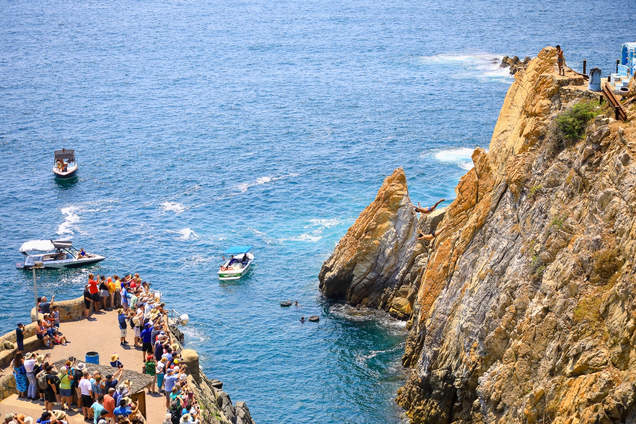
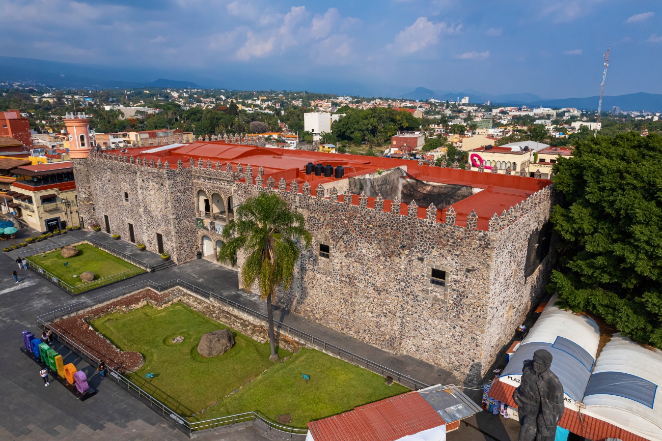
Los Cabos are actually two cities, Cabo San Lucas and San Jose del Cabo. They’re located at the southern tip of Baja California Sur. It’s one of the most important tourist destinations in Mexico, and very popular with US citizens, especially from California. Everyone has heard of “Cabos”. El Arco is its most recognizable, photographed symbol which is a rock formation sculpted by the sea. It’s where the Sea of Cortez (Gulf of California) and the Pacific Ocean meet.
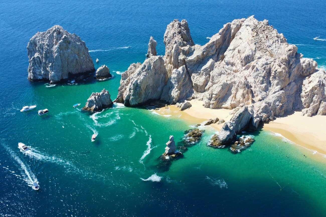
Monterrey is the capital of the state of Nuevo León. It’s located in the northeast of Mexico and is about 219 kilometers (136 miles) from the border with Nuevo Laredo and 217 Kilometers (135 miles) from McAllen, Texas, US. Monterrey is the third most populous city and one of the most developed cities in Mexico. Monterrey is big on business. It serves as the industrial and economic epicenter for Northern Mexico. It’s the home of FEMSA (Fomento Económico Mexicano, S.A.B. de C.V). If you’ve ever been to Mexico, you’ve certainly come across OXXO. Its Mexico’s version of 7-11 and there’s over 21,000 units throughout Latin America with the vast majority in Mexico. It doesn’t stop at OXXO. They’re the largest public Coca Cola bottler in the world. They’re a huge conglomerate with over 320,000 employees in 18 countries including Argentina, Austria, Brazil, Chile, Colombia, Costa Rica, Ecuador, Germany, Guatemala, Luxembourg, Mexico, Netherlands, Nicaragua, Panama, Peru, Switzerland, United States of America, and Uruguay. In 2018, Monterrey was named the Mexican city with the best quality of life according to Mercer Human Resource Consulting. San Pedro Garza García is part of the Monterrey Metropolitan Area and is the second safest municipality in Mexico. Many “criticize” Monterrey for being too much like the United States and “not Mexican”.
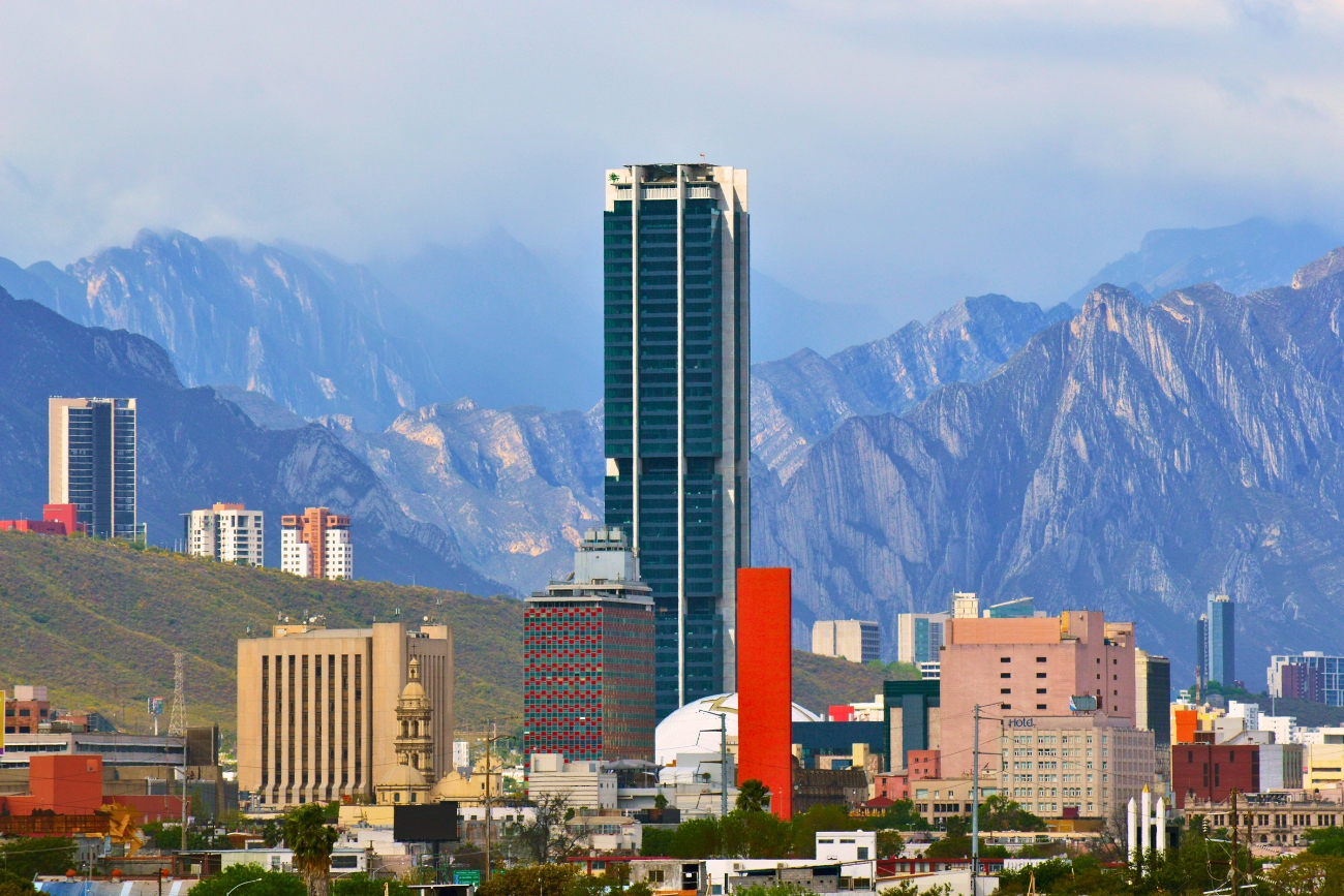
Oaxaca City is the capital of the state of the same name. It’s a very popular tourist destination in Mexico and welcomes national and international tourists. Oaxaca is an artsy, gastronomy destination full of culture and what most consider the best food in Mexico. Hierve el Agua is a set of natural rock formations that resemble cascades of water. The site is located about 70 kilometers (43.5 miles) east of Oaxaca city or about an hour and a half away. The water springs are over-saturated with calcium carbonate and other minerals that pour over the cliffs. The excess minerals are left behind, creating the effect, much in the same manner that stalactites are formed in caves and cenotes. Two other tourist destinations in the state of Oaxaca are the beautiful beach towns of Huatulco and Puerto Escondido.
Oaxacan cuisine shines with five specialties: chapulines (fried grasshoppers), mole, quesillo (string cheese), tlayudas, and the iconic mezcal, a cultural treasure.
Oaxaca, an UNESCO Favorite
Oaxaca state has 5 total UNESCO inscriptions. The following two are for Oaxaca City proper:
- Historic Centre of Oaxaca and Archaeological Site of Monte Albán (1987): This includes the colonial Historic Centre of Oaxaca City, with its 16th-century architecture and urban layout, alongside the nearby Monte Albán archaeological site.
- Oaxacan Cuisine (2010, as part of Traditional Mexican Cuisine): While this intangible heritage recognition applies broadly to Mexican cuisine, Oaxaca City is a major hub for this tradition, with its iconic dishes like mole, tlayudas and the use of quesillo, Oaxacan string cheese.
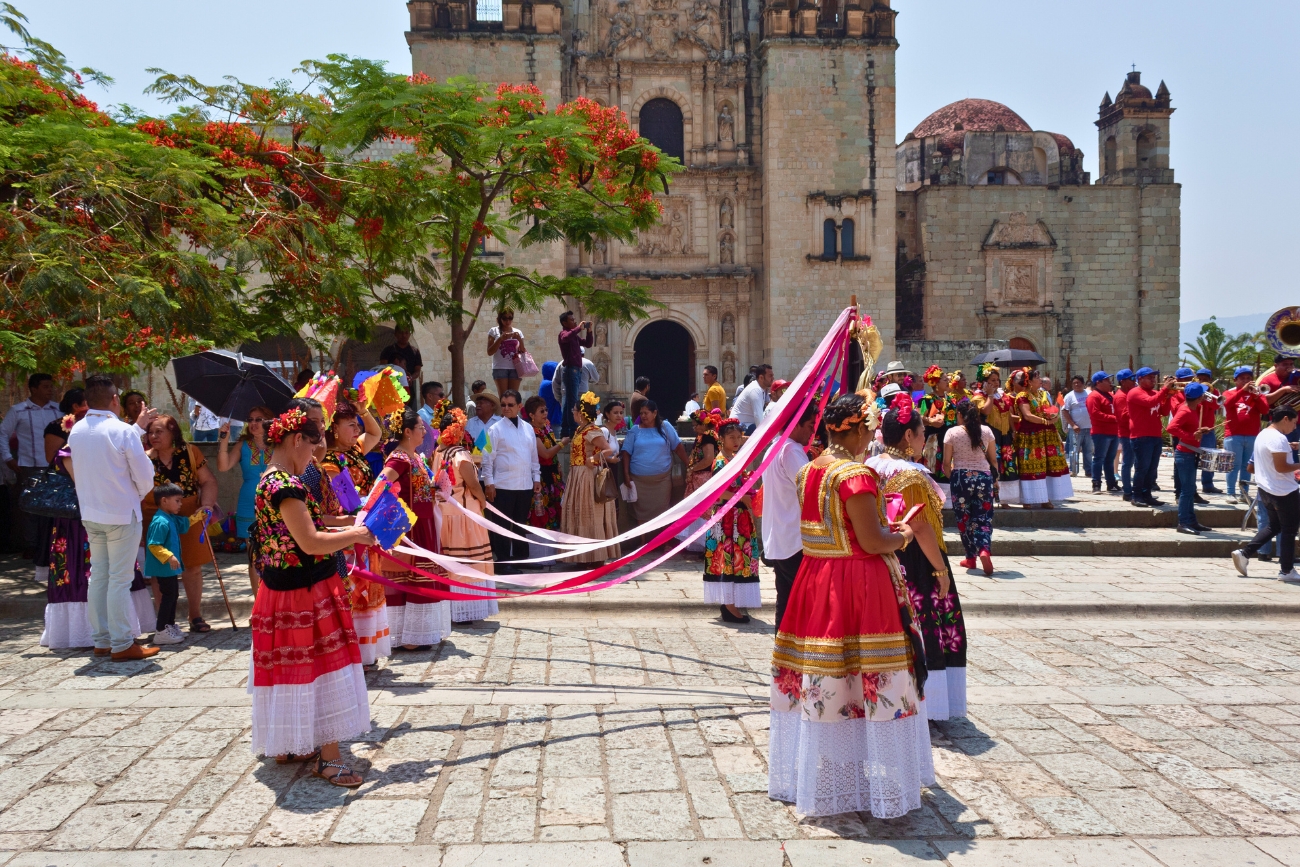
Elephant in the Room
It’s irresponsible for anyone to downplay the violence in Mexico. It’s real, it’s not “fake news”. Mexico, as a country, is one of the most dangerous in the world based off homicide rate per-100,000. It hardly matters what year the list was created. It may not always be the worst, but it’s almost always in the top 5. In 2025, it’ right up there with Jamaica, Ecuador and Brazil. Mexico also has a terrible reputation with violence against women. You see Mexican women protest the violence against them. It’s a real issue. Still, it varies tremendously depending on locations within Mexico.
Colima, CL Vs Mérida, Yucatán: Two Polar Opposites
Colima is the most dangerous city in the world by far in 2025 with regards to homicide rate per-100,000. Mérida, on the other hand has been listed as the second saftest city in the Western Hemisphere for a second time. Both cities are in Mexico. Physical violence is extremely rare in Mérida. I lived there for 5 years and never felt danger. My bicycle was stolen but that’s not physical danger. Therefore, it truly depends on WHERE SPECIFICALLY you live. It frustrating to hear “Mexico is so dangerous” or even “The US is so dangerous”. In reality there are certain cities that are indeed dangerous but blanketing an entire country with that label is disingenuous.
Despite Cartel Actions, Guns Are Severely Restricted in Mexico
Despite what cartels do, guns are highly restricted in Mexico, unlike the United States. Sure, there are some loopholes, and one can apply for a license to use at a shooting range, but firearms are time consuming and difficult to obtain legally. There’s no concealed carry allowed anywhere even if you get a permit. The weapon must remain at your residence unless you’re driving to the range. Additionally, the .38 is the highest caliber of firearm one can legally own and there is only one (1) store in Mexico City that sells guns and ammunition. That’s it. I decided to create a blog post regarding the War on Drugs and México’s involvement and leave it out of this general overview as it’s a bit extensive and I didn’t want to bog down this piece with guns, violence and narco talk.
Conclusion: Best Cities in Mexico for Expats
Hopefully you’ve gained some insight on some of the best cities in Mexico for expats. I believe there are cities in Mexico to suit everyone regardless of age or socioeconomic status. Some cities are almost polar opposites when compared to one another. That’s a good thing because it gives people options. From young coastal beach vibes with a rockin’ nightlife to the tranquil serenity in the highlands, there’s something for everyone.